The longer your route,the more you have to repeat the above operation which will help you keep the direction you
defined.
8
.
LET’S DEFINE OUR POSITION ON THE MAP
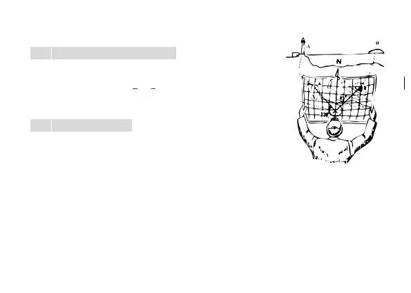
Select two well visible points on the ground and mark them on the map .Once
the map is orientated (operated as Point 6),with your compass measure the
value in degree of position (A) and draw a line on the map in accordance with
said value.Now pass through point (B).
9
.
LET’S USE THE CLINOMETER
The clinometer is an instrument allowing the measuring of differences in height
and slopes.It can be pendular or automatic.
Open the compass, adjust the Clinometer (11),until it is perpendicular to the
case(17).Aim at the upper(or inferior) edge of your target by the Aiming line(3)(inferior side),Pay attention as to
create one single line.The more your tilt the your compass,the more the clinometer changes its position.
Aim at the target and tilt the compass on the clinometer side so that the pendulum stops and read the angle of
inclination.
If the object be located inferiorly to the observer,simply turn the compass until the hinge(4) points to you ,aim at it by
viewing through the upper part of the lid and proceed in accordance with the above mentioned instructions.
 Loading...