21
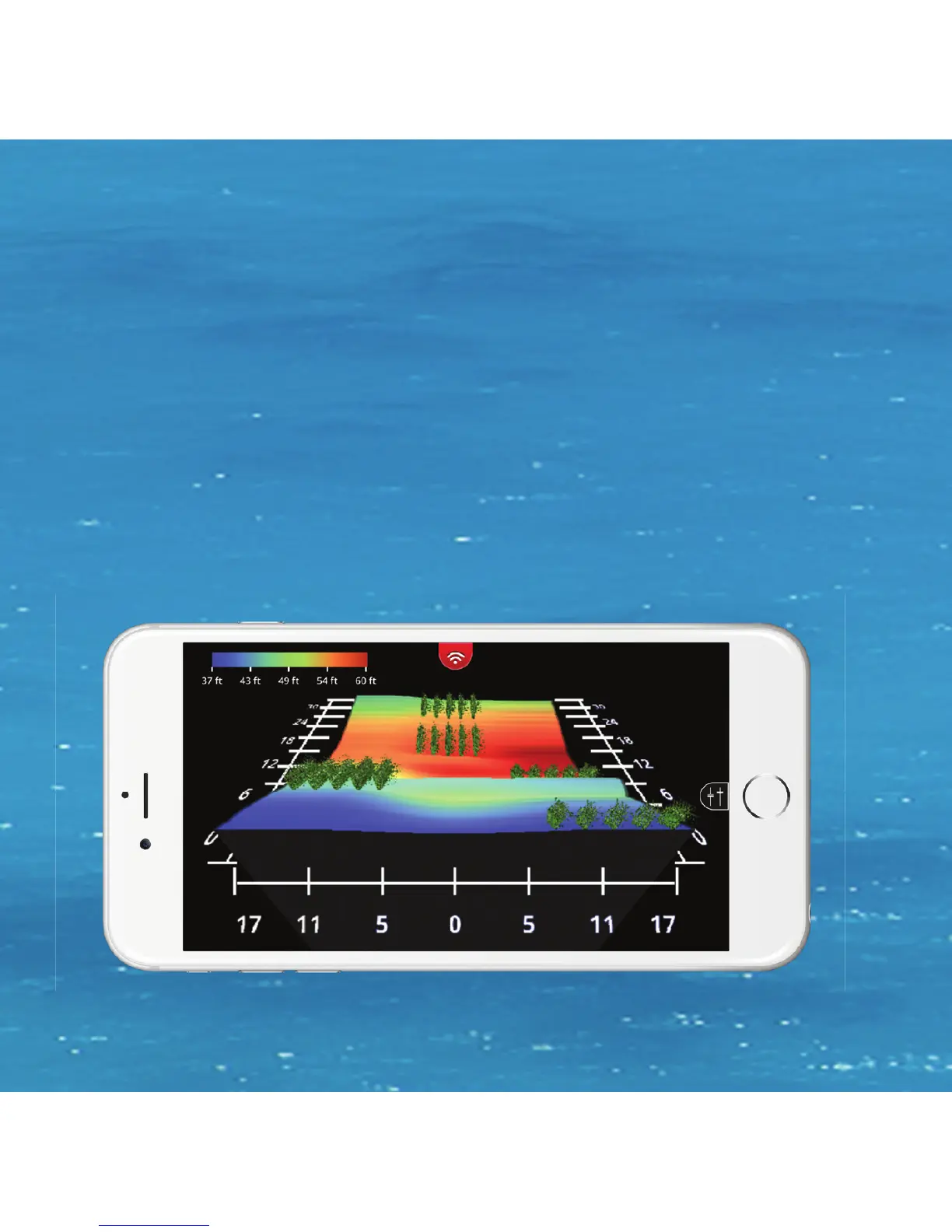
You can create custom 3D Structure Maps of your favorite fi shing
spots by placing the FishHunter in the water and then
reeling/drifting/trolling it over the area you want to measure.
Use the color coded scale to easily see drop offs or toggle on/off
the grid overlay to know exactly where the drop offs are, their
relative depth and distance. Every map has a GPS tag so you can
save the map and fi sh in the same spot next time- no problem.
21