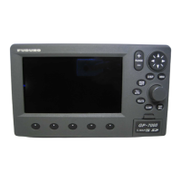
FURUNO
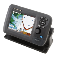
GP-170
SP - 1 E4482S01C
SPECIFICATIONS OF GPS NAVIGATOR
GP-170
1 GPS RECEIVER
1.1 Receiving frequency 1575.42 MHz
1.2 Tracking code C/A code
1.3 Number of channel GPS: 12 channels parallel, 12 satellites
1.4 Accuracy (dependent on ionospheric activity and multipath)
GPS 10 m approx. (2drms, HDOP<4)
DGPS 5 m approx. (2drms, HDOP<4)
WAAS 3 m approx. (2drms, HDOP<4)
MSAS 7 m approx. (2drms, HDOP<4)
1.5 Ship’s speed accuracy 0.2 kn (10kn or less), 2 % of ship’s speed (more than 10kn),
excluding influence of roll and pitch
1.6 Course accuracy ±3° (within 1 to 17kn), ±1° (more than 17kn)
1.7 Position fixing time Cold start: 90 s typical
1.8 Tracking velocity 1000 kn
1.9 Position update Interval* 1 s (standard), 0.1 s (minimum)
*: Set the position update interval 0.1 s or 0.2 s for high-speed craft. Set the positioning cycle
5 or 10 Hz according to the position update interval; 5/10 Hz for 0.2s interval, 10 Hz for 0.1s
interval.
2 DISPLAY SECTION
2.1 Display type Color LCD 116.16 x 87.12 mm, 640 x 480 dot matrix
2.2 Brilliance 700 cd/m
2
typical
2.3 Visible distance 0.625 m nominal
2.4 Display modes Plotter, Highway, Course, Data, Integrity
2.5 Projection Mercator
2.6 Track plotter display
Scale 0.125 to 1024 NM, 14 steps
Latitude limits Between 88° N and 88° S
Plot interval By time 0 to 60m00s or by distance 0 to 99.99 NM, sm/km or halt
2.7 Memory capacity
Track and marks Track: 1,000 points, Mark: 2,000 points
Waypoints 1,000 points with 20 characters comment each
Route 100 routes (containing 1,000 waypoints each)
No. 001 to 099: for registering routes
No. 100: for reading from USB flush memory/ synchronizing with
ECDIS
2.8 Notice Arrival and anchor watch, Cross track error, Speed, Trip
2.9 Alerts Differential positioning interruption, HDOP overshoot, Own ship
positioning fail, Own ship position lost, Beacon signal lost,
Beacon malfunction, Antenna short-circuit
2.10 Satellite information Satellite number, Bearing, Elevation, Signal level, DOP, Status

 Loading...