Do you have a question about the Garmin nuviCam and is the answer not in the manual?
Install a memory card for the dash camera to enable video recording.
Connect the device to vehicle power and mount it securely.
Establish satellite connection for accurate navigation.
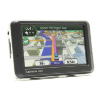
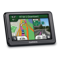
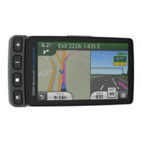
Understand the meaning of icons on the device's status bar.
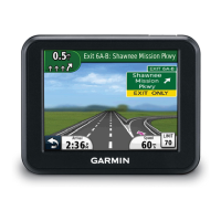
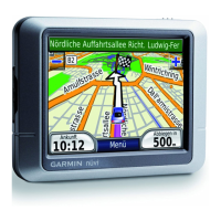
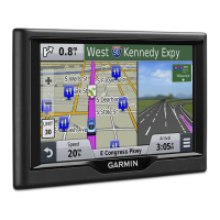
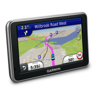
Learn to navigate and interact with the device using on-screen controls.
Conserve battery by putting the device into low-power sleep mode.
Properly shut down the device to conserve power and prevent data loss.
Control audio output levels and mute the device.
Configure volume to adjust automatically based on ambient noise.
Set the display brightness for optimal visibility.
Properly align the dash camera for optimal performance of ADAS features.
Understand how the dash camera records video automatically or manually.
Manually save video footage, especially during detected incidents.
Capture still images with the integrated dash camera.
Control the dash camera's recording functionality.
Learn tips for using the camera key to manage recordings and photos.
Access and view recorded video and photo files on the device.
Transfer and manage video and photo files on a computer.
Control whether audio is recorded with video footage.
Remove unwanted video or photo files from the memory card.
Receive alerts for potential forward collisions with vehicles.
Get alerts when the device detects unintentional lane departures.
Understand how routes are calculated and used for navigation.
Initiate navigation to a selected destination.
Quickly navigate to your pre-set home location.
Update or change the stored home address.
View the calculated route and driving information on the map interface.
Experience camera view at destinations for enhanced arrival guidance.
Incorporate additional stops or destinations into an active route.
Manually adjust the route's course by selecting specific roads or areas.
Modify the current route to avoid road issues like construction.
End the current navigation session.
Select preferences for route calculation (e.g., fastest time, shortest distance).
Initiate navigation by selecting a location directly from the map.
View and select from different route options before starting navigation.
Create and save multi-stop trips for future navigation.
Begin navigation for a previously planned and saved trip.
Automatically arrange trip stops for a more efficient route.
Modify the sequence or details of stops within a saved trip.
Save a current navigation route as a trip for later use.
Adjust route preferences, vehicle profile, or shaping points for a trip.
Add timing and layover information to trip stops.
Utilize myTrends to get predicted route suggestions based on travel history.
Configure the device to automatically avoid routes with traffic delays.
Set preferences to avoid routing through toll roads or areas.
Manage preferences for avoiding toll roads with specific sticker requirements.
Specify road features like ferries or unpaved roads to avoid.
Avoid areas with environmental or emissions restrictions.
Define specific road segments to be excluded from routes.
Mark specific geographic areas to be avoided during navigation.
Temporarily deactivate a custom avoidance without deleting it.
Remove previously set custom avoidances.
Enable Off Road mode for direct routing without roads.
Search for destinations using keywords like addresses or names.
Modify the geographic area used for location searches.
Browse and find various points of interest like restaurants or gas stations.
Search for destinations by selecting from predefined categories.
View quick lists of recently selected destinations within a category.
Find specific locations within larger venues like malls or airports.
View a list of all points of interest located within a specific venue.
Utilize Foursquare integration for location-based social networking features.
Search Foursquare points of interest using the device or connected app.
Link your device to your Foursquare account via Smartphone Link.
Access detailed information about Foursquare locations.
Use the device to check into Foursquare locations.
Search for a specific address by entering street and number.
Locate destinations by searching for street intersections.
Search for cities by name or proximity to another location.
Navigate to a location using its latitude and longitude coordinates.
Access a list of the last 50 destinations you have searched for.
Remove recently found destinations from the device's history.
Recall the location where you last parked your vehicle.
Access details about your current location for emergency situations.
Locate nearby hospitals, police stations, and fuel stations.
Generate a list of directions to share your current location.
Create shortcuts for quick access to locations, categories, or search tools.
Delete shortcuts from the Where To? menu.
Save frequently visited or important locations for quick access.
Save your current position as a named location.
Set a primary location, typically home, for easy navigation.
Navigate to your saved home location.
Modify the details of your saved home location.
Update the name, phone number, or category of a saved location.
Organize saved locations by assigning custom categories.
Remove saved locations from the device's memory.
Access quick tools and functions while viewing the map.
Activate and view specific map tools for enhanced map interaction.
Customize which map tools are available in the map tools menu.
View businesses and services along your route or current road.
View businesses and services along your route or current road.
Modify categories displayed in the Up Ahead feature.
Access detailed statistics about your trips and driving.
Display trip statistics directly on the map interface.
Select and configure the data fields shown in trip information.
Access a detailed page showing trip statistics and performance.
Review a record of the paths you have traveled.
Clear trip data, speed, or odometer readings.
See upcoming traffic incidents and delays along your route.
Display real-time traffic flow and delay information on the map.
Find and view details about specific traffic incidents.
Receive alerts for fixed speed and red-light cameras.
Control which data elements (POIs, road conditions) are displayed on the map.
Select the type of data displayed in map data fields.
Adjust the map view between 2-D Track Up, North Up, or 3-D.
Understand how to receive traffic information via a dedicated receiver.
Utilize Smartphone Link for real-time traffic data through your phone.
Information about the included or optional traffic receiver accessory.
Optimize traffic receiver placement for best signal reception.
Information on purchasing or renewing traffic data subscriptions.
Learn how traffic subscriptions activate automatically.
Check the status of your traffic data subscriptions.
Purchase and activate traffic subscriptions for different regions.
Turn traffic data services on or off.
Choose a word or phrase to activate voice command features.
Initiate voice command by speaking the wakeup phrase.
Tips for improving voice command recognition and usage.
Navigate to destinations using voice commands.
Disable voice prompts for voice commands without muting device audio.
Set up Voice Control by recording custom voice commands.
Operate the device using configured voice control commands.
Guidance for effective use of Voice Control features.
Connect your mobile phone to the device via Bluetooth.
Activate the Bluetooth feature on the device.
Information on automatic connection after initial phone pairing.
Temporarily disable the Bluetooth connection for a paired device.
Remove a paired phone from the device's list of connections.
Make a phone call by manually entering a number.
Initiate calls to contacts stored in the phone book.
Call a point of interest or saved location directly.
Answer or ignore incoming phone calls.
Access and review past call records.
Manage call features like transferring audio or muting.
Record your home phone number for quick dialing.
Initiate a call to your saved home phone number.
Access the device's built-in help section for assistance.
Find specific information within the help section by searching.
Understand the functionality of the Smartphone Link application.
Instructions for downloading and installing the Smartphone Link app.
Establish a connection between the device and Smartphone Link.
Transfer navigation destinations from your phone to the device.
Turn off hands-free calling while using Garmin Live Services.
Sign up for live data services like traffic and weather.
Information on viewing live traffic camera feeds.
Bookmark specific traffic cameras for easy access.
Access saved traffic camera feeds.
Enter vehicle information for accurate ecoRoute calculations.
Update the current fuel price for ecoRoute calculations.
Adjust fuel economy settings for more precise reporting.
Understand how ecoChallenge scores your driving habits for fuel efficiency.
Review your ecoChallenge scores for acceleration, braking, and speed.
Details on how acceleration, braking, and speed affect ecoChallenge scores.
Clear all recorded ecoChallenge scores.
Access detailed fuel economy data and reports.
Access and review past driving mileage and fuel economy reports.
Access and review past driving mileage and fuel economy reports.
Reset ecoRoute settings and vehicle profile data.
Receive advice for improving fuel efficiency and driving habits.
Check for notifications and messages from myGarmin.
Get detailed weather forecasts for specific days and locations.
Check weather conditions for favorite cities or new locations.
Analyze animated weather radar maps for current conditions.
Receive notifications for significant weather events.
View real-time information on road conditions and traffic.
Access historical data of routes and places visited.
Configure map display options and vehicle icon representation.
Adjust route calculation, avoidances, and navigation preferences.
Configure dash camera features like recording and warnings.
Manage Bluetooth connections and device identification.
Adjust screen brightness, color mode, and display timeout.
Enable traffic data, set providers, and configure traffic alerts.
Set measurement units and time format for the device.
Configure voice prompts, text language, and keyboard layout.
Set up alerts for approaching points of interest.
Manage device information, software versions, and privacy settings.
Return device settings to factory default values.
View details about the device, software, and license agreements.
Clean the device's exterior using mild detergent.
Clean the device's screen with a soft, lint-free cloth.
Take precautions to prevent device theft and damage.
Restart the device if it stops functioning properly.
View technical specifications of the device, including operating temperatures.
Access customer support, product manuals, and software updates.
Install Garmin Express software for device management.
Download and install the latest map and software updates.
Information on memory card types and their use for storage.
Insert a memory card to expand storage for maps and data.
Link the device to a computer using a USB cable for data transfer.
Copy files between your computer and the device.
Safely disconnect the device from a computer to prevent data loss.
Check the strength and status of the GPS signal.
Information about different power sources for the device.
Learn methods for charging the device's internal battery.
Replace the fuse in the vehicle power cable if the device does not charge.
Detach the device from its mount.
Separate the device mount from the suction cup assembly.
Detach the suction cup assembly from the vehicle windshield.
Instructions on how to purchase and install new map products.
Information on where to buy optional accessories for the device.
Solutions for mounting issues with the suction cup.
Troubleshoot problems with acquiring GPS satellite signals.
Diagnose and resolve issues related to vehicle charging.
Tips for improving battery life and troubleshooting drain issues.
Resolve issues where the device is not recognized as a drive.
Troubleshoot the device not appearing as a portable device.
Address issues where the device is not detected by the computer.
Troubleshoot Bluetooth connectivity problems between phone and device.
| Display Resolution | 800 x 480 pixels |
|---|---|
| Camera | Yes |
| Battery Life | Up to 30 minutes |
| Preloaded Maps | Yes |
| Voice-activated Navigation | Yes |
| Bluetooth | Yes |
| MicroSD Card Slot | Yes |
| External Memory | microSD card (not included) |
| Lane Departure Warning | Yes |
| Forward Collision Warning | Yes |
| Garmin Real Directions | Yes |
| Bluetooth Calling | Yes |
| Speed Limit Indicator | Yes |
| Junction View | Yes |
| Lane Assist | Yes |
| Wi-Fi | No |
| Lifetime Map Updates | Yes |
| Display Size | 6.0 inches |
| Traffic Updates | Yes |