Do you have a question about the Geonav 4 gipsy and is the answer not in the manual?
Portable chart plotter with built-in GPS receiver, 12-channel GPS, satellite acquisition time, and various functions.
Details input voltage (5 VDC) and rechargeable Li-Ion Polymer battery pack (2700 mAh).
Specifies limits for waypoints, trackpoints, markers, and storage capacity.
Lists available accessories including brackets, cables, adapters, speaker, and headset.
Advises on placement away from magnetic interference, unit's waterproof nature, and slot cover usage.
Recommends using nonalcoholic products for cleaning the glass display.
Discusses using built-in or external GPS antennas for outdoor or indoor installation.
Explains how to mount the plotter using the provided bracket and screws for optimal viewing.
Explains powering the GEONAV via car lighter plug or built-in battery pack, including cable connection.
Details the car lighter adapter, its LED indicator for power, and fuse checking procedures.
Describes the rechargeable battery pack, charging time, and battery life.
Explains connecting earphones or loudspeakers for audio output from the unit.
Instructions for inserting CompactFlash cards, with warnings about water infiltration and certified cartridges.
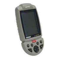
Details functions of ZOOM, ENT, PAGE, GOTO, CLR, CURSOR, and PWR keys.
How to access the diagnostic program to verify unit performance and detect problems.
Details chart features, range adjustment, and displaying chart elements like contours and names.
Explains various graphic elements displayed on the chart, including markers, tracks, and waypoints.
Covers unit operations like power, modes, GPS selection, chart rotation, and calibration.
Initial setup, chart loading, and acquiring a satellite fix.
Describes Cursor and Navigation modes for interacting with the unit.
Overview of various information windows: Range, Navigation, Trip, Satellite, Info, Tide, Runway, 3D.
Overview of menu options for navigation and settings.
Detailed procedures for creating, editing, saving, and recalling routes.
Functionality for recording, saving, and recalling the boat's track.
Procedures for inserting, modifying, deleting, and routing to markers.
Planning routes to ports and finding nearest services.
Configuration options for display, navigation, units, language, and windows.
Safety warnings regarding car navigator installation and use.
Describes road map display, routes, and points of interest.
Covers unit operations like power, modes, and voice instructions for car navigation.
Initial start-up display of welcome and warning messages.
Shows navigation status, trip data, satellite info, and route details for road travel.
Menu options for Marker, Addresses, Near services, and Setup.
Inserting, defining, and deleting markers for road navigation.
Managing addresses: entering new ones and selecting/deleting stored entries.
Searching for and selecting nearest services like restaurants or hotels.
Defining itineraries by setting starting points and destinations using the cursor.
Configuration for path preferences, roads, usage, units, language, and windows.
| Brand | Geonav |
|---|---|
| Model | 4 gipsy |
| Category | Marine GPS System |
| Language | English |