EasyManua.ls Logo

Honeywell EGPWS MK VII - Non-Peaks Display

Honeywell EGPWS MK VII
126 pages
To Next Page IconTo Next Page
To Previous Page IconTo Previous Page
Loading...
Mark V and Mark VII EGPWS Pilot’s Guide
060-4241-000 System Description
Rev H, August 2011 31
Non-Peaks
Display
Continued
Each specific color and intensity represents terrain (and
obstacles) below, at, or above the aircraft’s altitude based on
the aircraft’s position with respect to the terrain in the
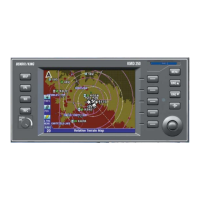
database. If no terrain data is available in the terrain database,
then this area is displayed in a low-density magenta color.
Terrain more than 2000 feet below the aircraft, or within 400
(vertical) feet of the nearest runway elevation, is not displayed
(black). With version -218-218 or later, the transition to black
may occur below 400 feet based on runway and terrain
database integrity for a given area.
When a caution alert is triggered, the terrain (or obstacle) that
created the alert is changed to solid yellow (100% density) as
illustrated below.
TERRAIN IS SHOWN
IN SHADES OF GREEN,
YELLOW AND RED

Related product manuals