Black plate (284,1)
Model "INFINITI_NAVI" EDITED: 2006/ 3/ 20
CURRENT VEHICLE LOCATION
DISPLAY OF CURRENT VEHICLE LO-
CATION
This navigation system combines the data
obtained from the vehicle (by gyro sensor)
and from GPS (Global Positioning System)
satellites to calculate the current location
of the vehicle. This position is then
displayed throughout route guidance to a
destination.
WHAT IS GPS (Global Positioning
System)?
GPS is a position detecting system that
uses satellites deployed by the U.S.
government. This navigation system re-
ceives radio signals from three or more
different satellites that orbit 13,049 miles
(21,000 km) above the earth in space, and
detects th e position of the vehicle by
utilizing the principle of triangulation.
INV2775
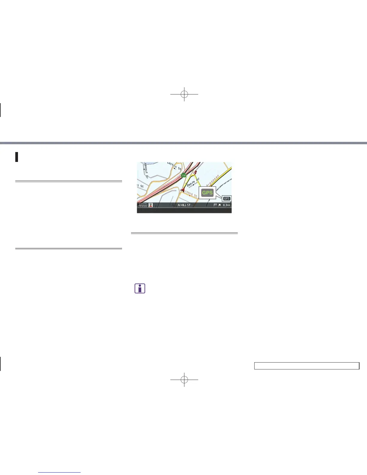
ACCURACY OF POSITIONING
The color of the GPS indicator in the lower
right corner of the screen indicates the
accuracy of positioning as follows:
. Green: accurate positioning is possible
. Gray: accurate positioning is not pos-
sible
INFO:
For approximately 3 or 4 minutes after starting
the system, the GPS indicator remains gray,
even if accurate positioning is possible.
Positioning adjustment
When the system judges that the vehicle
position information is not accurate based
on vehicle speed and gyro sensor data
calculations, the system will automatically
adjust the position of the vehicle icon
using GPS signals.
Receiving signals from GPS satel-
lites
The reception of GPS signals can be weak,
depending on the environment. Vehicles in
the following areas/environments may not
receive GPS signals (indicator color: gray).
10. General system information
10-4
 Loading...