Do you have a question about the Motorola MOTONAV and is the answer not in the manual?
Provides essential rules for safe operation while driving.
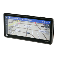
Guides users through the initial software setup and configuration process.
Introduces the navigation menu, live map, and map features.
Explains various methods for inputting a destination, such as addresses and POIs.
Explains how to find and navigate to points of interest using quick search.
Covers changing destinations, starting points, pausing, deleting, and adjusting route preferences.
Selecting different methods for calculating routes (Fast, Short, Economical, Easy).
Saving an active route's destination to your favorites list.
Explains the automatic zoom feature that adjusts map view based on driving context.
Details how routes are calculated and automatically recalculated due to deviations or traffic.
How to set up and receive warnings for exceeding speed limits.
Using traffic information to optimize routes and receive real-time updates.
Explains basic interaction methods like tapping buttons and using checkboxes.
Covers advanced touch interactions like tap & hold, drag & drop, and screen rotation.
Instructions on using the on-screen keyboard for entering text and symbols.
Describes the main menu and its core functions for navigation.
Explains the live map view, including Vehimarker and GPS status.
Explains the Vehimarker and cursor for identifying current location and destinations.
Details street display, and next maneuver information shown on the map.
Describes how lane information and road signs are displayed for navigation.
Explains supported 3D map elements like terrain, landmarks, and buildings.
Details elements displayed on the map during an active route.
Accessing quick settings like map view, zoom, colors, and location information.
How to find your current position and nearby emergency services.
Accessing additional features like travel applications, tutorial, and extras.
Accessing core settings like route, sound, vehicle, and regional preferences.
How to change map and menu color themes for day and night use.
Adjusting key sounds, speed limit warnings, and speed camera warnings.
Customizing the vehicle marker displayed on the map.
Customizing language, time, units, and keyboard layout.
Explains how GPS signals are used to determine position and elevation.
Defines the currently navigated path from start to destination.
Defines the central point of a city or town for navigation purposes.
Describes customizable visual themes for map and menu displays.
Explains the digital maps used, including 2D and 3D views.
Web portal for activating licenses, buying content, and support.
POI for speed/red light cameras and associated warning features.
The icon representing the user's current position on the map.
| Category | Navigation software |
|---|---|
| Maps | Tele Atlas |
| Developer | Motorola |
| Platform | Windows Mobile |
| Features | Turn-by-turn navigation |
| Compatible devices | Motorola smartphones |