Do you have a question about the Navigon 7100 and is the answer not in the manual?
Details on the styles and symbols used for clarity in the manual.
Explanation of formatting styles used for legibility and clarification.
Defines symbols used to refer to specific passages of text.
States that the software and manual are subject to change without notice.
Disclaims liability for accuracy and damages resulting from manual use.
Information on registered trademarks and third-party rights.
Contact information and service hours for customer support.
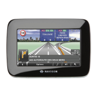
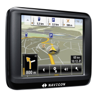
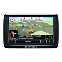
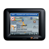
Overview of the NAVIGON 7100's features and capabilities.
Explains how GPS technology works and its role in navigation.
Lists the accessories included with the NAVIGON 7100 device.
Provides critical safety notices and guidelines for using the navigation system.
Details safety precautions related to the device itself, including water and heat.
Safety advice for mounting the device and routing cables in a vehicle.
Instructions for initial setup, including charging the battery.
Steps for inserting the SD memory card into the device.
Procedure for safely removing the memory card from the device.
Instructions on how to attach and secure the device cradle.
Details on attaching the navigation device to its cradle using a bayonet fitting.
How to power the device using the car charger cable.
Instructions for connecting the TMC antenna for traffic information.
Step-by-step guide to powering on and starting the navigation software.
Overview of the main user interface and its primary navigation functions.
Function to quickly navigate to a pre-set home address.
Accessing saved and recently used destinations.
Using voice commands to initiate navigation or access features.
Details on accessing various settings and planning windows.
How to navigate back to the main screen from other windows.
Explains the GPS initialization process and status indicators.
Adjusting the volume for spoken driving instructions.
Understanding the icons for GPS reception and battery status.
Explains the directional indicator and compass points.
Information on receiving and using traffic updates for route planning.
Using the device for hands-free mobile phone operations.
How to use the on-screen keyboards for text input.
Guidance on navigating through menus and selecting functions.
Interface for setting and managing the device password.
Procedure for creating a new password to protect the device.
Steps to modify an existing password for the device.
How to disable the password protection feature.
Guidance on what to do if the device password is forgotten.
How the auto-complete feature helps in selecting destinations.
Procedure for choosing the map area for destination searches.
Methods for finding locations by specifying city or street details.
Guide to searching for Points of Interest like restaurants or gas stations.
Information on using Zagat survey data for POI categories.
Selecting destinations by interacting directly with the map.
Detailed steps for entering destination addresses by city or street.
Methods for selecting POIs as navigation destinations.
How to find POIs of nationwide significance.
Finding POIs within a particular city or region.
Using direct access to quickly find pre-selected POI categories.
Procedure for configuring the direct access POI shortcuts.
Accessing detailed information, like phone numbers, for POIs.
Viewing detailed Zagat survey results for specific POIs.
Using the map interface to pinpoint and select a destination.
How to save entered destinations to the Favorites list.
Saving the device's current GPS position as a destination.
Designating a saved destination as the home address for quick navigation.
Associating voice commands with saved destinations for hands-free navigation.
Methods for selecting destinations from saved lists.
Navigating to destinations previously saved in the Favorites list.
Initiating navigation to a destination using a stored voice command.
Quickly navigating to the saved home address.
Initiating the navigation process and handling GPS reception issues.
How to open the window for planning and managing routes.
Specifying the initial location for route calculation.
Modifying the starting point after it has been initially set.
Adding multiple destinations or waypoints to a route.
Rearranging the sequence of destinations within a planned route.
Saving, loading, renaming, or deleting planned routes.
Starting navigation, calculating routes, and handling GPS signal interruptions.
Reviewing and adjusting route calculation settings.
Simulating navigation without actual GPS reception.
Displaying detailed, step-by-step driving directions.
Omitting specific road segments from the calculated route.
Reverting blocked route sections to the original calculated path.
Notification and display when the destination is reached.
Viewing the planned route and destination before starting navigation.
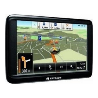
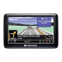
The primary map view during active navigation.
Map view used for searching and selecting destinations.
Interacting with the map to select destinations and perform actions.
Visual representation of complex highway junctions for clearer guidance.
Manually switching from Reality View back to the standard navigation map.
How to open the window displaying traffic information.
Overview of the traffic message display and its components.
Explanation of color codes indicating the impact of traffic events.
Description of icons used to represent various traffic events.
View detailed information about specific traffic events.
How to view and interpret traffic reports on the device.
How to request a new route to avoid traffic jams or obstructions.
Configuration options for the TMC receiver and traffic alerts.
Setting preferences for automatic or on-request route recalculations.
Filtering traffic information to show only desired message types.
Interface for managing Bluetooth phone connections and calls.
Initial steps to activate and begin using the hands-free feature.
Procedure for disconnecting the Bluetooth hands-free connection.
Steps for pairing and establishing a Bluetooth connection with a mobile phone.
How to accept or reject incoming calls via the hands-free system.
Methods for initiating phone calls using the device.
Using the device as a hands-free kit even when dialing from the phone.
Managing call functions like volume and microphone mute.
Moving an active call between the device and the mobile phone.
Inputting numbers during an active call, e.g., for phone system connections.
Switching from a call back to the main navigation map view.
Procedure for terminating an active phone call.
Solutions for common problems encountered with Bluetooth connectivity.
Initiating the recording of vehicle mileage and trips.
Procedure for ending the recording of vehicle mileage.
How to open the main settings menu for customization.
Overview of the settings interface for personalizing the device.
Customizing Points of Interest display and direct access categories.
Selecting and managing the active navigation map.
Configuring route calculation preferences like speed and route type.
Navigating through different settings and options.
Accessing help and detailed explanations for specific settings.
Confirming and saving modified settings.
Canceling and reverting any changes made to settings.
Legal warning regarding windshield mounts in specific states.
UL disclaimer regarding GPS hardware and software performance/reliability.
Detailed technical specifications of the NAVIGON 7100 device.
FCC compliance statement for the device.