38
Chapter5:Chartapp
5.
1Chartappoverview
TheChartappdisplaysarepresentationofyourvesselinrelationto
landmassesandotherchartedobjects,whichenablesyoutoplanand
navigatetoyourdesireddestination.TheChartapprequiresaGNSS
positionfixinordertodisplayyourvesselatthecorrectlocationona
worldmap.
ForeachinstanceoftheChartappyoucanselectwhichelectronic
cartographythatyouwanttouse,theselectionwillpersistovera
powercycle.
TheChartappcanbedisplayedinbothFullscreenandsplitscreenapp
pages.Apppagesmayconsistofupto4instancesoftheChartapp.
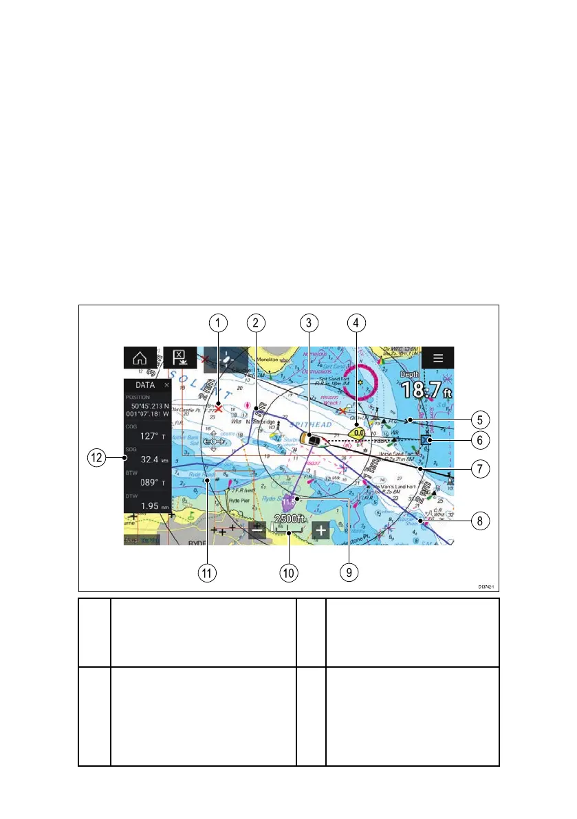
1
W aypoint
Usewaypointstomark
specificlocationorpointsof
interest.
2
Track
Y oucanrecordthe
passageyourvesseltakes
usingTracks.
3
V esselicon
Representsyourvessel,
onlydisplayedwhenGNSS
positionfixisavailable(icon
willbeablackdotifno
Headingisavailable).
4
Windindicator
Providesindicationofwind
directionandspeed(Wind
transducerrequired).
 Loading...