•Axiommultifunctiondisplay,runningLightHouse™4version4.5orlater.
•AlphaSeriesdisplayand
Axiommultifunctiondisplay,runningLightHouse™
4version4.5orlater.
•i70ori70sinstrument,runningsoftwareversion3.21orlater.
Displayingmastrotationangledata
Inordertodisplaymastrotationangledata,thefollowingRaymarine®devices
mustbeavailableonthenetwork:
•Axiommultifunctiondisplay,runningLightHouse™4version4.5orlater.
•Vesselheadingdatafromaseparateheadingsensorisrequired.Examples
ofRaymarinedevicesthatproducevesselheadingdatainclude:
–EV-1(E70537)
–EV-2(E70097)
–AR200(E70096)
Additionaldatarequirements
Someofthewindtransducer’sdataoutputandcalculationsaredependent
onthetransducerreceivingthefollowingdatafromotherdevices.
•SOG(SpeedOverGround)andCOG(CourseOverGround)—thisdata,
typicallyprovidedbyaGNSS(GPS)receiver,isrequiredforanetworked
multifunctiondisplay/chartplottertooutputGroundwinddata.
•Vesselheading—thisdata,usuallyprovidedbyaheadingsensoror
autopilotsystem,isrequiredforanetworkedmultifunctiondisplay/
chartplottertooutputMastrotationangledata.
•STW(SpeedThroughWater)—thisdata,providedbyaspeedtransducer,
isrequiredforanetworkedmultifunctiondisplay/chartplottertooutput
accurateTrueWindandBack-calculatedApparentWinddata.Withouta
speedtransducer,thedatawillbeapproximatedonly,andistherefore
lessaccurate.
Note:
•Foralistofavailablespeedtransducersandheadingsensors,referto:
p.59—Sparesandaccessories
•ForalistofsupportedNMEA2000PGNsreferto:
p.67—SupportedNMEA2000PGNs
3.3Systemexample
Thesystemexamplebelowshowsdevicesthatcanbeconnectedin
conjunctionwiththeSmartWindtransducertoamultifunctiondisplay/
chartplotterinordertodisplayandcalculateaccuratewinddata.
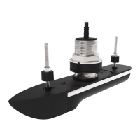
1.RSW-WiredSmartWindtransducer.
2.GNSS(GPS)receiver(e.g.:RS150).
3.Headingsensor(e.g.:EV-1).
4.NMEA2000gateway(supplied).
5.i70sinstrumentdisplay,runningsoftwareversion3.21orlater.
6.Alphaseriesdisplays.
7.SeaTalkng®12Vdcpowerconnection.
8.Speedtransducer(e.g.:DST800).
14
 Loading...