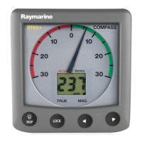
2 ST60 Graphic Display Operating Guide
To select the chapter you want
momentary
press
1 sec
press
Chapter selection and content
Note: For more details on page
content, refer to the Chapter and
page details section in this chapter.
SATELLITES
HDOP
Depth graph
Speed graph
True wind speed graph
Apparent wind angle graph
Ground wind angle graph
Apparent wind speed graph
True wind angle graph
Heading graph
Sea temperature graph
Battery voltage graph
VMG Windward
Maximum speed
Minimum depth
Maximum depth
Ground wind angle
Beaufort wind force
Cardinal wind direction
Tack course
DMG distance made good)
CMG (course made good)
FAVORITE
Favorite page 5
Favorite page 4
Favorite page 7
Favorite page 6
Favorite page 3
Favorite page 2
Favorite page 1
To step forward
To step back
Current depth
DEPTH
Speed
Speed
Average speed
Log
Trip log
SOG (speed over ground)
SOG
Timer
SPEED
WIND
Apparent wind speed
True wind speed
Apparent wind angle
True wind angle (sail)
COG (course over ground)
Locked heading
Current heading
Heading
COG (course over ground)
HEADING
NAVIGATE
BTW (bearing to waypoint)
DTW (distance to waypoint)
Speed
Position
COG (course over ground)
COG (course over ground)
BTW (bearing to waypoint)
COG
Heading
SOG
XTE (cross track error)
(Longitude & Latitude)
SOG (speed over ground)
Waypoint number or name
ENVIRONMENT
Sea temperature
Battery voltage
Date
Time
Pilot status
Rudder angle
AUTOPILOT
Note: AUTOPILOT
chapter available only if
a Raymarine autopilot
system is connected to
SeaTalk
D6431-1
Rolling road
VMG to waypoint
81226_1.book Page 2 Wednesday, November 19, 2003 9:53 AM

 Loading...