Do you have a question about the SM Modellbau gps-logger 2 and is the answer not in the manual?
Details on installing the GPS-Logger 2 for optimal performance and antenna placement.
Guidance on selecting and using compatible micro SD cards for data storage.
Explanation of the status indications provided by the device's LEDs.
Configuration options for telemetry, data rate, start mode, and other essential parameters.
Setting up and managing audible or visual alarms via the telemetry system.
Methods for initiating and terminating data logging, including automatic options.
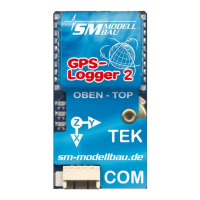
Details the high-resolution Vario sensor, TEK connection, and Vario output via telemetry.
Guide for connecting the GPS-Logger 2 without using telemetry features.
How to switch between live, min, and max values using a receiver channel.
Connecting the GPS-Logger 2 directly to the telemetry port of compatible systems.
Instructions for connecting the GPS-Logger 2 with UniLog 1/2 or UniSens-E devices.
Detailed operation and features of the GPS-Logger 2 with Jeti Duplex telemetry systems.
Using the GPS-Logger 2 with the Multiplex M-Link telemetry system for data display.
Connecting and operating the GPS-Logger 2 with Graupner HoTT telemetry systems.
Integrating the GPS-Logger 2 as an S.BUS2 sensor for Futaba FASSTest telemetry.
Using the GPS-Logger 2 with JR Propo DMSS telemetry for height and Vario data.
Connecting and using the GPS-Logger 2 with FrSky telemetry via S.Port connection.
Steps to convert GPS-Logger 2 data files into Google Earth™™ .kmz format.
Viewing the extreme values of converted data in the 'Maximum' window.
Configuring GPS-Logger 2 parameters like data rate, start mode, and telemetry settings.
Specifying preferences for IGC mode, which are included in the IGC file.
Accessing the GPS-Logger 2 directly via PC's USB interface using terminal software.
Finding software information, Google Earth™™ settings, and automatic update options.
| Channels | 50 |
|---|---|
| Update rate | 5 Hz |
| Position Accuracy | 2.5 m |
| Velocity Accuracy | 0.1 m/s |
| Data Logging | Yes |
| Interface | USB |
| Current Consumption | 60mA |
| GPS Chipset | u-blox |
| GPS Module | u-blox MAX-7 |