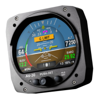
AV-30 Quick Reference Card
MFD (Traffic Display)
FILTER
▪ NORMAL – Filter ownship,
traffic above and below
2700 feet relative to
ownship.
▪ ABOVE – Filter ownship,
traffic above 8700 feet
and below 2700 feet
relative to ownship.
▪ BELOW – Filter ownship,
traffic above 2700 feet
and below 8700 feet
relative to ownship.
▪ ONLY OWN – Filter only
ownship.
▪ NONE – Displays all traffic
and ownship.
Select
1:1 OR AI
For tailBeaconX
Target type
Callsign or Flight Identifier
Distance, altitude, and
airspeed of target
Highlighted tracked target
Direction of Flight,
Relative Altitude*, and
Ascent Indicator
OWNSHIP ICAO
Enter ICAO number
*
Pitot and static must be
connected to display
proper relative altitude.
1. Rotate to change position
2. Push to change
3. Rotate to change value
4. Push again to accept
5. Push right button to save
www.uavionix.com/support
Support: (844) 827
-2372
FOR REFERENCE ONLY
UAV-1005760-001 Rev E
GPS track
Heading and position
will be established by
the first available out of
the following GPS
sources:
Wi-Fi ADS-B In Unit
AV-30 Connected GPS
Ownship Traffic Target
Scale
0.33 TO 40 NM
Rotate center knob to
zoom
Traffic Status
▪ NO DATA – AV-Link not
connected/not functional
▪ NO GPS SRC – ADS-B In unit not
sending GPS data, AV-30 has no
configured GPS source, and no
ownship traffic target found
▪ NO GPS FIX – No GPS source
reports valid coordinates
▪ NO ALTITUDE – No source
reports valid altitude
▪ NO GPS HDG – No source
reports valid heading
Traffic Count
▪ NO TRAFFIC – Zero
aircraft detected OR
ADS-B In unit not
reporting traffic
▪ X AIRCRAFT –
Number of aircraft
detected, including
those filtered and
those off-screen
 Loading...


