Do you have a question about the Advanced Navigation Spatial Dual and is the answer not in the manual?
Global Navigation Satellite System overview.
Inertial Navigation System principles and error characteristics.
Benefits of combining GNSS and INS for enhanced accuracy.
Attitude and Heading Reference System using sensors.
Defines the X, Y, Z axes for inertial sensors.
Explains Euler angles for orientation.
Describes latitude, longitude, and height for position.
North-East-Down coordinate system for velocity/position.
Earth-Centered, Earth-Fixed coordinate system.
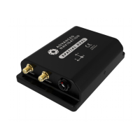
Lists all items included in the evaluation kit.
Step-by-step guide to initial setup and operation.
Instructions for assembling the antenna mount.
Part numbers for the complete evaluation kit.
Part numbers for standalone Spatial Dual units.
Details on available license upgrades for GNSS.
Lists available accessories for the system.
Visual representation of device dimensions.
Key performance parameters for navigation.
Accuracy based on antenna separation.
Technical details of internal sensors.
Performance parameters for the GNSS receiver.
Details on interface and protocols.
General hardware attributes like voltage, temp, weight.
Voltage and current requirements for interfaces.
Details of the ODU connector and wire functions.
Step-by-step guide for system installation.
Guidelines for optimal unit placement and orientation.
Guidelines for mounting and positioning GNSS antennas.
Options for integrating odometer input for navigation.
Advice on magnetic interference for heading performance.
Strategies for mounting the unit to tolerate vibration.
Overview of the four initialisation levels.
Functionality for rapid system startup after power loss.
Options for determining heading (Dual Antenna, Velocity, External).
Using RTK GNSS for significantly higher positional accuracy.
Limits and precautions for environmental conditions.
Hardware and driver requirements for the software.
How to run the Spatial Dual Manager software.
Solutions for common software issues.
Overview of the main software interface.
Automatic data logging and conversion to CSV/GPX.
Accessing configuration settings for the device.
Setting offsets for device and antenna alignment.
Utilities for firmware updates and log conversion.
Integrating external position, velocity, or heading data.
Overview of multi-function GPIO and RS232 ports.
Input for high-resolution speed sensors.
Defines the ANPP packet and header format.
Configuring periodic output rates for packets.
Comprehensive packet with system status and data.
Packet containing raw sensor readings.
Packet with raw data from the GNSS receiver.
Packet with geodetic coordinates (Lat, Lon, Height).
Packet with ECEF coordinates.
Packet with UTM coordinates.
Packet for setting installation alignment offsets.
Packet for configuring GPIO pin functions.
Configures offsets for dual antenna setups.
| Category | Car Navigation system |
|---|---|
| Manufacturer | Advanced Navigation |
| Product Name | Spatial Dual |
| Update Rate | 200 Hz |
| Power Supply | 9-36 VDC |
| Operating Temperature | -40°C to 85°C |
| Heading Accuracy | 0.1° |
| Interfaces | RS232, RS422, USB |
| GNSS Support | GPS, GLONASS, Galileo, BeiDou |
| Accuracy (Heading) | 0.1° |