Do you have a question about the Apelco 530 and is the answer not in the manual?
Device is completely waterproof for mounting in any location on any console.
Continuous display of bottom conditions and midwater fish with 4x zoom.
Stores up to 200 waypoints and 10 routes; accepts optional GPS antennas.
Positive ID of fish presence and size using six symbols. Includes shallow/deep alarms.
Features auto range, sensitivity, and zoom for hands-off operation.
Contact details for Apelco Marine Electronics in the United States.
Contact details for Raytheon Marine Europe in the United Kingdom.
Device is an aid to navigation; user must exercise prudence and judgment.
System uses sonar to show conditions, detect fish, and includes GPS capabilities.
Check standard equipment upon receipt; notify dealer of missing items.
Mounting the display unit using yoke or optional flush mount kits.
Details on mounting the transducer, including positioning and bracket attachment.
Instructions for installing a thru-hull transducer, including location and fairing block use.
Guidance on connecting the unit to a 12 VDC power system, including polarity and fuse.
Steps for installing the GPS antenna and connecting it to the display unit.
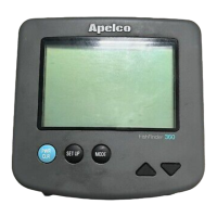
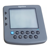
Explanation of keypad functions for navigation and data entry.
Overview of turning the unit on/off and selecting operating modes.
Description of the FishFinder mode display and its basic functions.
Explains how to display and cycle through various information windows.
Details on setting range, sensitivity, white line, zoom, and bottom lock.
Overview of entering Navigation mode and its sub-modes.
Instructions for storing, naming, and entering waypoints using Lat/Lon, TD's, or B/R.
Guidance on planning, selecting, programming, deleting, reviewing, and editing routes.
Configuring general system settings like contrast, units, and language.
Adjusting alarms, chart speed, and calibrating temperature/speed.
Settings for alarm sound, magnetic variation, L/L correction, and Loran GRI.
Options for alarm sound, track clearing, and track interval settings.
Settings for sorting, moving, erasing waypoints, and setting alarms.
Configuring geodetic datum, antenna height, and local/UTC time.
Explanation of how sonar technology works and its basic principles.
How to interpret different seabed conditions based on display readings.
Introduction to the GPS system, satellites, and position calculation.
Tips for cleaning, inspecting hardware, and protecting the transducer.
Guidance on diagnosing and resolving common operational problems.
Technical details and operational parameters of the unit.
| Brand | Apelco |
|---|---|
| Model | 530 |
| Category | Fish Finder |
| Language | English |