Do you have a question about the B&G Zeus2 and is the answer not in the manual?
Legal disclaimers and liability information for the product.
Lists registered trademarks associated with the product and its components.
Lists other Navico products mentioned in the manual.
States the copyright information for the manual.
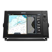
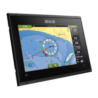
Details the physical buttons and controls on the Zeus2 unit.
Describes the main screen for accessing applications and functions.
Explains how applications are displayed and organized on the Zeus2.
Covers connecting and integrating external devices with the Zeus2 system.
Details the integration with the B&G H5000 Instrument and Autopilot system.
Explains how to connect and use remote control units with the Zeus2.
Instructions for powering the Zeus2 unit on and off.
How to adjust screen brightness and use night mode.
Procedure to temporarily lock or unlock the touchscreen interface.
Basic gestures and interactions for using the touchscreen.
How to navigate menus, dialog boxes, and use controls.
How to choose and activate different pages and panels on the display.
Steps to create a MOB waypoint in emergency situations.
How to take and save screenshots of the Zeus2 display.
How to change the background image on the Home page.
How to resize panels in split-screen views.
Setting up a PIN code to secure system settings.
Creating custom pages by combining panels.
Modifying or removing existing favorite pages.
Configuring the data displayed in the Instrument bar.
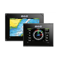
Overview of the chart display and its elements.
Information on available cartography sources and types.
Displaying two different chart types simultaneously.
How to choose the desired chart type for a panel.
Moving the chart display in different directions.
Zooming in and out on the chart display.
How the vessel's position is represented on the chart.
Options for chart orientation (North up, Heading up, Course up).
Accessing details for waypoints, routes, and other chart objects.
Navigating and interacting with the chart using the cursor.
Navigating to a specific position using the cursor.
Creating and saving new waypoints on the chart.
Planning and creating navigation routes.
Using the cursor to measure distances on the chart.
Searching for specific items or vessels on the chart.
Using the 3D view for chart display and controlling the angle.
Displaying radar, StructureScan, or weather data over the chart.
Specific options and settings for Insight chart data.
Specific options and settings for Navionics chart data.
Specific options and settings for Jeppesen chart data.
General settings and display options for chart panels.
Configuring layline display on charts and SailSteer panels.
Graphic presentation of cross track error limits for routes.
Enabling display and management of waypoints, routes, and tracks.
Creating and managing navigation waypoints.
Procedures for saving waypoints at specific locations.
How to reposition an existing waypoint.
Modifying all information related to a waypoint.
Setting audible alarms for waypoints based on proximity.
Creating, editing, and navigating routes.
Step-by-step guide to drawing a new route.
Modifying an existing route by adding or moving points.
Using automatic features to suggest route points.
Transforming recorded tracks into navigable routes.
Recording and displaying the vessel's historical path.
Starting and managing the track recording function.
Configuring how track points are recorded.
Accessing advanced functions for managing waypoints, routes, and tracks.
Starting navigation towards a selected cursor point.
Initiating navigation along a pre-defined route.
How to begin route navigation directly from the chart.
Initiating route navigation via the dedicated Route dialog.
Stopping an active navigation sequence.
Integrating autopilot for automated navigation.
Configuring navigation parameters like method, radius, and alarms.
Selecting formats for displaying latitude and longitude coordinates.
Enabling and configuring the Phantom Loran positioning system.
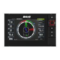
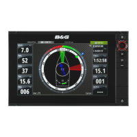
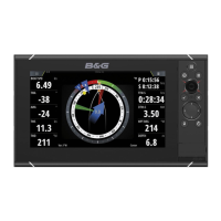
Customizing the data displayed on the SailSteer panel.
System calculations for sailing distance, time, and ETA to waypoint.
Displaying SailSteer data as an overlay on the chart.
Selecting which data to show on the Race panel.
Overlaying the race start line onto the chart display.
Displaying detailed data related to the race start line.
Configuring the port and starboard ends of the race start line.
Visualizing the start line, boat position, and laylines.
Using boat lengths for race timer and bias advantage measurements.
Assessing potential changes in wind or tide for race strategy.
Using the timer for countdowns or elapsed time tracking.
Displaying historical data in time-based plots.
Customizing the data fields and time range for time plots.
Displaying wind speed and direction history.
Important safety warnings and guidelines for autopilot use.
Steps to engage the autopilot system.
Transitioning the autopilot between automatic and manual control.
Visual cues indicating autopilot status on different displays.
Overview of the dedicated autopilot display panel.
Detailed explanation of available autopilot steering modes.
How to put the autopilot into standby mode.
Using NFU mode for manual rudder control.
Using FU mode for proportional rudder control.
Engaging automatic steering based on set heading.
How the autopilot captures the current heading during a turn.
Performing tacking maneuvers in AUTO mode.
Maintaining a course by compensating for drift.
Using helm control to avoid obstacles while in NoDrift mode.
Steering the vessel to a waypoint or along a route.
Automatic steering based on apparent or true wind angle.
Performing tacking maneuvers in WIND mode.
Procedures for performing a gybe maneuver.
Navigating using both wind and position data.
Using automatic turn patterns for navigation.
Following a specific depth contour with the autopilot.
Connecting and controlling the autopilot with AP24/AP28 units.
Integrating the autopilot with an EVC system.
Configuring chart compass, locking, and sea state filter.
Adjusting tack time and tack angle for sailing.
Autopilot selection between apparent and true wind steering.
Optimizing performance for Velocity Made Good to wind.
Using laylines for efficient navigation and course correction.
Adjusting steering response levels (HI/LO).
Overview and adjustment of autopilot steering parameters.
Overview of the radar display and its elements.
Connecting and viewing two radar images simultaneously.
Choosing which radar to display or overlay.
Displaying radar images on the chart panel.
Setting the radar source for chart overlays.
Controlling radar scanner modes (Off, Standby, Transmit).
Adjusting the radar display range.
Using independent range controls for dual radar systems.
Navigating and interacting with the radar display using the cursor.
Navigating to a selected position on the radar image.
Saving waypoints from radar targets or positions.
Optimizing radar display with sensitivity and filtering.
Filtering unwanted radar echoes.
Controlling radar receiver sensitivity.
Filtering echoes from waves and rough water.
Reducing clutter caused by rain or weather.
Noise rejection, radar threshold, and target expansion settings.
Customizing radar display elements like symbology and trails.
Setting the duration for radar target trails.
Temporarily removing target trails from the radar display.
Selecting color schemes for the radar display.
Setting how the radar image is oriented (Heading, North, Course).
Adjusting the radar PPI center and vessel movement display.
Using electronic bearing lines and variable range markers for measurements.
Defining radar zones to alert for target entry or exit.
Tracking up to ten radar targets for collision avoidance.
Saving radar data for later analysis or simulation.
General settings for radar symbology, bearings, and data bar.
Overview of the echosounder display and its components.
Adjusting the zoom level of the echosounder display.
Navigating and interacting with the echosounder display using the cursor.
Navigating to a selected position on the echosounder image.
Saving waypoints from echosounder readings.
Reviewing previously recorded echosounder data.
Configuring depth range, auto/custom range settings.
Selecting transducer frequencies for optimal sonar performance.
Adjusting image colors and gain for clarity.
Temporarily stopping the echosounder display for examination.
Noise rejection, TVG, and scroll speed settings.
Controlling the transducer's ping rate for optimal sonar.
Beginning the recording of echosounder and StructureScan data.
Reviewing saved echosounder log files.
Settings for split screen, zoom, and bottom lock modes.
Selecting display palettes for various fishing conditions.
Configuring Echosounder source and installation.
Overview of the StructureScan display and its views.
Adjusting the zoom level of the StructureScan display.
Navigating and interacting with the StructureScan display.
Measuring distances between points on the StructureScan image.
Saving waypoints from StructureScan data.
Reviewing recorded StructureScan image history.
Configuring range, frequencies, and contrast settings.
Temporarily stopping the StructureScan display for examination.
TVG, flipping image, range lines, and recording data options.
Overlaying SideScan images onto a chart for visualization.
Turning on the Structure overlay feature on the chart.
Selecting live data or saved files for StructureMap.
Advice for optimal StructureMap scanning and conversion.
Recording StructureScan data for conversion to StructureMap.
Creating StructureMap files from recorded StructureScan data.
Utilizing mapping cards with StructureMap feature.
Adjusting settings for StructureMap display and sources.
Overview of the ForwardScan sonar display.
Configuring depth, forward range, and noise rejection.
Adjusting display options like palette, history, and zones.
Monitoring ForwardScan data on the chart panel via heading extension.
Configuring critical ranges and depths for alarms.
Adjusting transducer angle for optimal depth readings.
Compensating depth readings based on vessel draft or waterline.
Establishing and ending connections to Wi-Fi hotspots.
Accessing the GoFree Shop for compatible content and software updates.
Using mobile devices to view and control the system wirelessly.
Transferring recorded log files for map creation.
Configuring wireless network settings and device connections.
Managing connected wireless devices for remote access.
Viewing and managing wireless module and connected devices.
Understanding the different symbols used for AIS targets.
Searching for and viewing details of AIS targets.
Initiating DSC calls to other vessels via VHF radio.
Receiving and displaying data from AIS SART beacons.
Handling alarm messages from AIS SART devices.
Setting alarms for target proximity and loss.
Configuring alarms for vessels entering predefined CPA or TCPA.
Setting alarms for vessels lost within a defined range.
Activating alarms for received AIS target messages.
Configuring vessel MMSI, icon filters, and extension lines.
Setting up invisible guard zones to identify dangerous targets.
Using extension lines to show target speed and course.
Setting AIS icon orientation based on heading or COG.
Overview of predefined dashboard styles for data display.
Changing gauges, layouts, and adding new dashboards.
Step-by-step guide to modifying dashboard gauges and data.
Activating audio devices connected to the NMEA 2000 network.
Overview of the audio panel and its controls.
Details of icons for controlling audio sources and playback.
Tools for managing tuner, VHF, and playback functions.
Configuring speakers, volume, and tuner regions.
Step-by-step guide to controlling the audio system.
Creating and managing lists of favorite audio channels.
Using Sirius radio features, channels, and favorites.
Understanding wind direction and speed indicators.
Displaying detailed information for weather observations.
Importing and displaying GRIB forecast data.
Overlaying GRIB weather data on the chart panel.
Visualizing weather system development through animation.
Connecting to SiriusXM for weather data services.
Checking Sirius weather module signal and service status.
Overlaying Sirius weather information on the chart.
Customizing weather display elements like precipitation and wave height.
Setting up alarms for lightning, storms, or marine zone forecasts.
Overview of the video display panel and its capabilities.
Configuring video source, standard, and image adjustments.
Connecting and controlling a FLIR camera via the system.
Steps to connect and recognize a FLIR camera on the network.
Controlling camera pan and tilt movements.
Adjusting zoom levels for digital and optical zoom.
Selecting daylight or infrared video sources and color schemes.
Setting and returning to the camera's home position.
How the system monitors for dangerous situations and faults.
Classifying alarm messages by color code and importance.
Display format for individual alarm messages.
How multiple simultaneous alarms are displayed.
Options for acknowledging and handling alarm messages.
Accessing and configuring alarm settings and history.
Listing and managing waypoints, routes, and tracks.
Displaying tide information for nearby stations.
Accessing lists of active alarms, history, and settings.
Providing access to application and system settings.
Listing and viewing information about AIS, MARPA, and DSC vessels.
Displaying sunrise, sunset, and moonrise/moonset times.
Tracking voyage and engine information.
File management system for various data types.
Search function for chart items like waypoints and tracks.
Automatic demonstration of product features.
Selecting data files for simulator operations.
Manually controlling simulator parameters like GPS source and sailing data.
Recommended maintenance procedures for the unit.
Instructions for cleaning the screen safely.
How to clean the media port to prevent salt crystallization.
Ensuring physical buttons are not stuck.
Visual inspection of unit connectors.
Logging NMEA data for service and fault finding.
Saving log files to a chosen destination.
Information on downloading and installing the latest software.
Recommended procedures for backing up user data and settings.
Backing up all navigational data from the system.
Selecting a specific area for exporting data.
Removing old data to improve system performance.
| Touchscreen | Yes |
|---|---|
| Cartography | Navionics, C-MAP |
| Sonar Compatibility | Yes |
| Autopilot Compatibility | Yes |
| Connectivity | Wi-Fi |
| GPS Receiver | 10 Hz GPS |
| Networking | Ethernet, NMEA 0183, NMEA 2000 |
| Operating Voltage | 9-32 V DC |
| Radar Compatibility | Yes |
| Operating Temperature | -15°C to +55°C (5°F to 131°F) |
| Power Supply | 9-32 V DC |
| Resolution | 800 x 480 pixels (7-inch), 1280 x 800 pixels (12-inch) |