Do you have a question about the B&G ZEUS3 and is the answer not in the manual?
Describes the physical controls on the front of the Zeus3 unit.
Explains the main screen for accessing applications and settings.
Details how applications are displayed on panels.
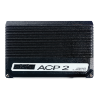
Explains connecting and integrating third-party devices.
Provides quick access to basic system settings.
Describes the procedure for powering the unit on and off.
Describes how to temporarily lock the touchscreen.
Details basic touchscreen gestures and interactions.
Guide to changing the background image of the Home page.
Customizing the function of the WheelKey.
Setting up a PIN code for system security.
Creating custom favorite pages for quick access.
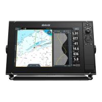
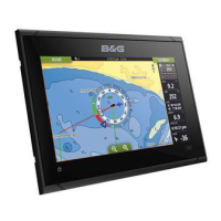
Overview of the chart display and its elements.
Information on available cartography and data sources.
How chart orientation affects vessel display.
How to use the cursor for navigation and selection.
Defining and positioning waypoints on charts or images.
Creating and navigating a series of routepoints.
Recording and displaying the vessel's path.
Automatic route planning considering boat size and maps.
Starting navigation towards a cursor-defined point.
Following a pre-defined route.
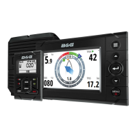
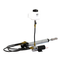
Using the autopilot for automated navigation.
Configuring various navigation parameters.
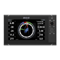
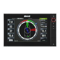
Overview of the SailSteer display and its components.
Customizing the data displayed on the SailSteer panel.
Calculating sailing times to waypoints.
Overlaying SailSteer data onto the chart.
Functionality and purpose of the race panel.
Displaying race start lines on the chart.
Step-by-step guide to configuring a race start line.
Using the timer for race countdowns or elapsed time.
Displays historical data in various layouts.
Specialized plot for wind speed and direction history.
Customizing data fields and time ranges for plots.
Displaying GRIB weather overlays on charts.
Entering user credentials for PredictWind services.
Setting up automatic download of weather data.
Planning optimal routes based on weather forecasts.
Important safety considerations when using autopilot.
Steps to engage and disengage the autopilot.
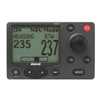
Detailed explanation of various autopilot steering modes.
Autopilot steering to waypoints or routes using GPS data.
Overview of the radar display interface.
Using two radar sources simultaneously.
Controlling radar transmission states.
Defining areas for target detection alarms.
Overview of the echosounder display and its components.
Interacting with the echosounder image using the cursor.
Adjusting echosounder display settings.
Configuring various echosounder display and source options.
Overview of the StructureScan display and its components.
Interacting with the StructureScan display using the cursor.
Configuring StructureScan image parameters.
Accessing advanced settings for StructureScan.
Overview of the StructureMap display and its interaction with charts.
Enabling StructureScan images on the chart.
Selecting data sources for StructureMap overlays.
Advice for optimizing StructureMap usage.
Explanation of the ForwardScan display elements.
Configuring ForwardScan display parameters.
Initial configuration steps for ForwardScan.
Setting thresholds for critical zone detection.
Overview of wireless capabilities and features.
Steps to connect to and disconnect from Wi-Fi hotspots.
Configuring general wireless functionality.
Sharing echosounder logs for map creation.
Explaining the various symbols used for AIS targets.
Initiating DSC calls to AIS vessels.
Setting alarms for target proximity and status.
Configuring vessel-specific settings related to AIS.
Overview of instrument panels and their data display capabilities.
Predefined dashboard styles for different information types.
Personalizing gauges, layouts, and adding dashboards.
Modifying the data displayed on a specific dashboard gauge.
Steps to enable audio devices connected via NMEA 2000.
Pairing the SonicHub 2 with Bluetooth devices.
Overview of the audio control interface.
Configuring speaker zones and master volume.
Working with GRIB format weather forecast files.
Loading GRIB files into memory for display.
Showing GRIB data as an overlay on the chart.
Setting alarms for weather conditions and watchboxes.
Setting up the video display panel.
Configuring video sources and display settings.
Controlling FLIR cameras connected to the system.
Steps to connect and recognize FLIR cameras.
Overview of how the alarm system functions and alerts.
Classification of alarm messages by color and importance.
Steps to acknowledge and handle alarm messages.
Accessing the main dialog for alarm settings.
Managing waypoint lists, routes, and tracks.
Accessing alarm lists and settings.
Accessing application and system settings.
Managing system files and SD card content.
Running an automated demonstration of the unit's features.
Selecting data files for simulator operation.
Manually controlling simulator parameters.
Recommended routine care for the unit.
Instructions for safely cleaning the screen.
Downloading and installing the latest software.
Regularly backing up system settings and data.
| Display Size | 7", 9", 12", 16" |
|---|---|
| Chartplotter | Yes |
| Expandable Storage | MicroSD card slot |
| GPS | 10 Hz GPS/GLONASS receiver |
| Connectivity | Wi-Fi, Ethernet, NMEA 2000 |
| Sonar | CHIRP |
| Operating System | B&G software interface |
| Operating Voltage | 12V DC |
| Waterproof Rating | IPX6/IPX7 |
| Radar Support | Yes, supports B&G radar systems |