1840-11
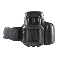
GPS Mode
What is GPS?
The Global Positioning System (GPS) was originally developed and is
currently operated by the United States Department of Defense. The space
segment of the GPS consists of the NAVSTAR satellites that are orbiting
21,000 kilometers above the Earth over six equally spaced orbital planes.
When signals are received from a minimum of three satellites, the principal of
triangulation is used to determine the current location of the GPS Watch
based on the distance between each satellite and the watch, and the orbital
path of each satellite.
Important!
• The signals produced by GPS satellites are controlled by the GPS Master
Control Station at Colorado Springs, Colorado. Signals may be subject to
reduced precision and even interruption without notice.
Almanac and Ephemeris Data
The data message sent from a GPS satellite consists of an
almanac
that
gives the approximate positions of all the other satellites in the system, and
the satellite
ephemeris
that contains precise information about the position of
the host satellite.
How quickly the watch is able to acquire the data it needs to determine your
position depends on a number of factors. One of the most important factors is
the status of almanac and ephemeris data in watch memory. There are two
possible data conditions from which you can start when performing a GPS
measurement:
hot start, warm start
.
Important!
• The above terms and their definitions are based on current standard
American English usage. Definitions may differ according to language and
geographic area.
Whenever the watch determines that the almanac data it currently has in
memory is no longer valid, it receives new almanac data from one of the
satellites overhead. The message RECEIVING SATELLITE DATA appears on
the display of the watch to indicate when almanac data is being received. Be
sure to leave the watch with its antenna facing the sky whenever this
message is on the display.
Factors that Affect GPS Signal Reception
Signal reception from GPS satellites may be difficult or even impossible under
the following conditions.
• Inside buildings or underground
• Among tall buildings
• In densely wooded areas
• Near high voltage lines
• Inside a motor vehicle
• When the antenna is covered by your sleeve, etc.
Navigation Precautions
• Never perform navigation operations while walking, cycling, or
operating a motor vehicle. Doing so can lead to accidents.
• Do not use this watch as a main navigation device for a boat or
aircraft. Doing so can lead to accidents.
• Though a useful navigational tool, a GPS receiver should never be
used as a replacement for conventional map and compass
techniques. Remember that magnetic compasses can work at
temperatures well below zero, have no batteries, and are
mechanically simple. They are easy to operate and understand, and
will operate almost anywhere. For these reasons, the magnetic
compass should still be your main navigation tool.
Data Reliability
• The global positioning system (GPS) is administered by the United States,
which also takes responsibility for all maintenance, management, and
precision adjustments. Because of this, there may be unforeseen changes
in the system and the signals it generates.
Start Type
Hot Start
Warm Start
Description
• GPS receiver circuit shut off for a very short time
(few minutes at most).
• Watch has not been moved to a different location
since last measurement.
• Both almanac and emphemeris data from last
measurement still in memory.
• GPS receiver circuit shut off for a long time
(over night, etc.)
• Watch has not been moved to a different location
since last measurement.
• Almanac data from last measurement still in
memory, but no ephemeris data.
Graphical Navigation Screen
• Though the Current Direction Screen can be used when travelling at
speeds of less than 8 kilometers per hour, measurement accuracy is greatly
reduced.
• The message SEARCH appears on the screen if buildings or other
obstructions interfere with signal receipt while the Current Direction Screen
is on the display during Continuous Mode measurements. The Current
Direction Screen will return as soon as the next successful measurement is
achieved.
• The maximum distance that can be displayed on the Graphical Navigation
Screen is 9999 kilometers.
• The direction pointer may remain on the Current Direction Screen even if
you come to a full stop.
• The appearance of the destination pointer changes automatically
depending on the relative direction of the destination.
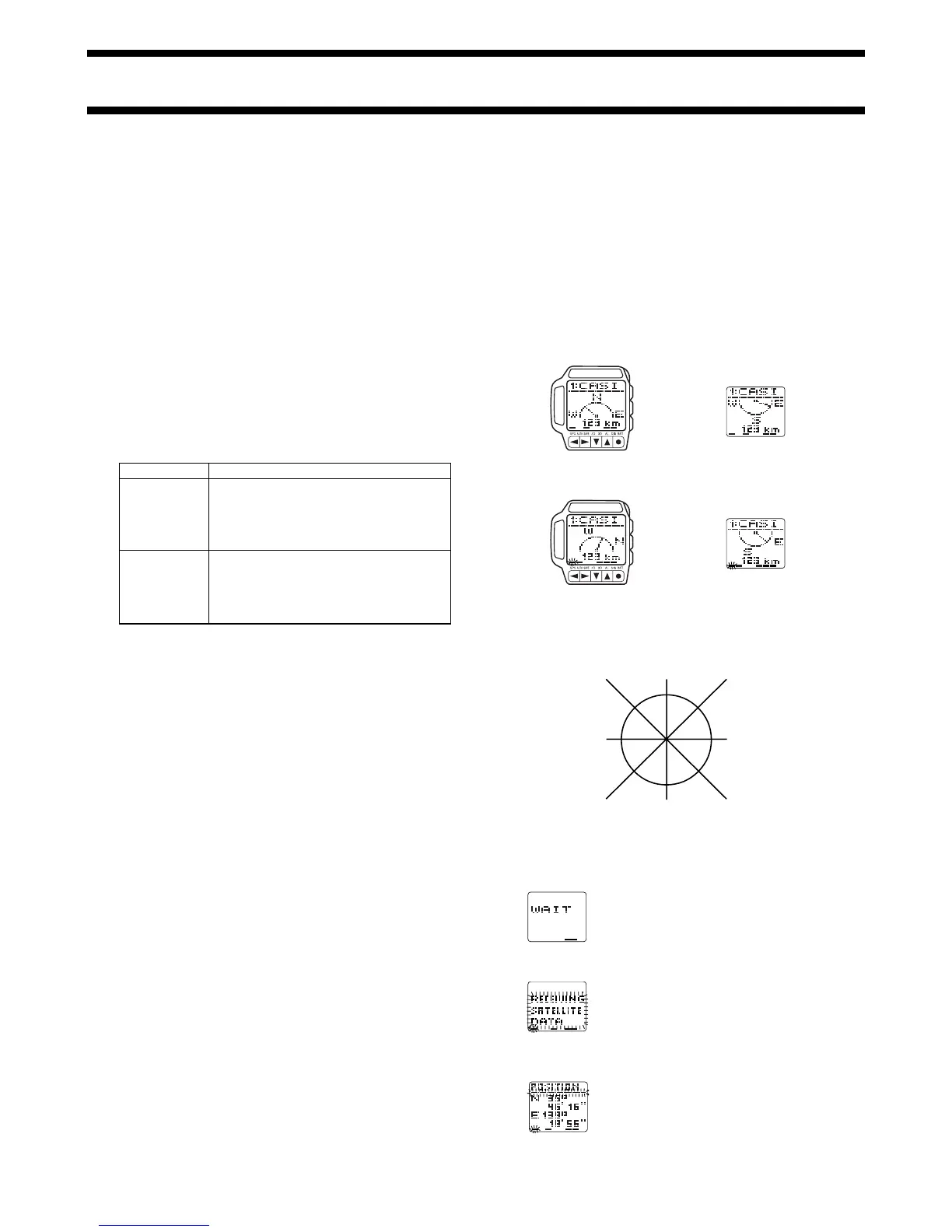
Fixed Direction Screen
Destination towards the North Destination towards the South
Current Direction Screen
Destination in front of you Destination in back of you
Bearing and Direction Values
Bearing and direction are indicated on the Direction and Speed Screens as
values that represent degrees. The following illustration shows the meanings
of these values.
0° = North 45° = Northeast
90° = East
135° = Southeast
180° = South
225° = Southwest
270°= West
315° = Northwest
Display Indicators and Messages
The following describes some of the indicators and messages that appear on
the display of the watch. These are normal and do not indicate malfunction.
Wait Message
This message indicates that the watch is
busy performing some procedure. Never
remove the battery from the watch while the
WAIT message is on the display.
Data Receive Message
This message indicates that the watch is
receiving satellite data. A data receive
operation can take about 20 minutes to
complete. Leave the watch with its face
facing towards the sky during this period.
Flashing GPS Indicator
The bar at the top of the screens in the GPS
Mode flashes while the watch is receiving
ephemeris data. Ephemeris data contains
precise information about the position of the
host satellite and the satellite clock time.
Do not perform any button operations while
the bar is flashing.
➜
 Loading...