Do you have a question about the DeLorme Earthmate GPS PN-60 and is the answer not in the manual?
Guide to setting up your PN-60 and SPOT Communicator.
Information on installing batteries, SD cards, and checking battery status.
Instructions on how to turn the device on and off.
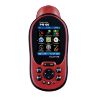
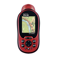
Overview of the device's main screen and its icons.
Controls for power, backlight, and locking buttons.
Searching for addresses, points of interest, and more.
Details on the Power and SOS buttons.
Status indication via the Power light.
GPS status indication via the GPS light.
How to use the SOS button for emergencies.
Steps to pair the PN-60w with the SPOT Communicator.
Description of icons used to navigate the Home Page.
How to change, create, and customize activities.
Displays visible satellites and signal strength.
Explains GPS and WAAS status indicators.
Describes GPS status like No Fix, 2-D, 3-D, and WAAS.
Methods to disable or enable GPS tracking.
How GPS accuracy is displayed and affected.
Displays GPS signal strength and direction.
Settings for map scale and orientation.
Retrieving details about objects on the map.
Using the tool to measure distances and polygon areas.
Customizing map display and data layers.
Changing the map's orientation (North Up, Heading Up, Course Up).
Managing route navigation settings.
Displaying direction to destination or back on course.
How the electronic compass works and its accuracy.
Stopping navigation, getting back on track, switching route types.
Customizing displayed information fields for trips.
Managing route navigation settings.
Introduction to the SPOT Communicator page features.
Pairing and connecting the SPOT Communicator.
Managing message sending via the SPOT Communicator.
Understanding message priority (Critical, Urgent, Casual).
Different types of messages that can be sent.
Using SOS for emergency notifications.
Notifying contacts of non-life-threatening situations.
Sending status updates or field notes.
Sending location data for tracking and sharing.
Step-by-step guide to sending messages.
Monitoring the status of sent messages.
Logging geocache finds via the SPOT Communicator.
Accessing a log of sent messages.
Searching for locations, points of interest, and more.
Using map center or name-based search.
Steps and tips for finding locations.
Saving search results as waypoints.
Generating routes to search results.
Organizing and managing waypoint data using GPX files.
Organizing geocache data using GPX files.
Adjusting route calculation and 'back on track' options.
Modifying calculation methods and tracking preferences.
Settings for staying on or returning to a route.
Steps to create a new route from the current position.
Following pre-created or saved routes on the map.
Displaying active and saved tracks on the map.
Customizing how tracks are recorded (points by, interval, full track behavior).
Starting, stopping, and clearing active tracks.
Retracing tracks and viewing elevation profiles.
Saving track data and managing GPX files.
Retracing saved tracks and simulating playback.
Understanding track elevation profiles over distance or time.
Modifying GPS/WAAS, battery type, USB power, and memory.
Configuring GPS, power saving, demo mode, and sleep modes.
Adjusting color scheme, backlight, and screen rotation.
Configuring device connection modes for computer interaction.
Enabling/disabling sensors and calibration options.
Procedures for calibrating sensors.
Managing wireless antenna and SPOT pairing.
Managing waypoints, geocaches, and tracks using GPX files.
Steps for calibrating the electronic compass.
Detailed steps to calibrate the compass.
| Water Resistance | IPX7 |
|---|---|
| Map Support | Yes |
| Display Resolution | 240 x 320 pixels |
| High-sensitivity receiver | Yes |
| Interface | USB |
| Resolution | 240 x 320 pixels |
| Channels | 20 |
| Connectivity | USB |
| Display Type | color TFT |
| Battery | 2 AA batteries |
| Accepts data cards | Yes, microSD |
| Waypoints/favorites/locations | 1000 |
| Display | 2.2" color TFT |
| Sensors | Barometric altimeter |
| Display Size | 2.2 inches |
| Battery Life | 18 h |