EN
9
Usage
Field Planning
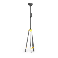
1. Ensure that the mapper has adequate power, sucient free space on the
Micro SD card (max capacity 16 GB) and that it is inserted into the slot on
the mapper correctly.
2. Press the power button once, then again, and hold to turn on the mapper.
3. Ensure that the upper left corner of the screen shows “BS”. If it shows “RC”, press
and hold the Mode button to switch to “BS”.
4. Wait for initialization to complete. The lower left corner of the screen shows "GNSS"
and the center shows “Ready” if RTK data is obtained and used.
5. Press and hold the Start/Stop Measurement button to start.
6. The center of the screen will show “Edge X-Y”. “X” means the recorded point
number for the edge measurement and “Y” means the recorded calibration point
number.
7. Walk alongside the boundary of the eld and press the Add Waypoint button once
to record a point. The corresponding number will increase by one.
8. If any obstacles are in the operating area, press the Obstacle Measurement button
once to enter Obstacle Measurement mode. The center of the screen will show
“Obstacle Z-N.” “Z” is for the recorded point number around the obstacle. Walk
alongside the boundary of the obstacle and press the Add Waypoint button once to
record a point. Z will increase by one.
“N” refers to the Nth obstacle being measured, meaning that each time you enter
Obstacle Measurement mode N will increase by one.
After obstacle measurement, press the Obstacle Measurement button once to exit
from the mode and continue edge measurement.
Edge 0-0
BS
Obstacle 0-0
 Loading...