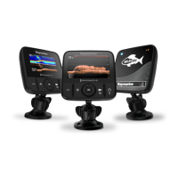
The Raymarine Dragonfly series, including Dragonfly-4, Dragonfly-5, Dragonfly-7, and Wi-Fish models, are standalone fishfinder and/or chartplotter products designed for marine navigation and fish targeting. This document provides comprehensive installation and operation instructions for these devices.
Function Description:
The Dragonfly series offers a range of functionalities depending on the specific model. All models provide core fishfinding capabilities, while Pro and M variants add chartplotter functions and satellite-based navigation. The Wi-Fish model is a standalone Wi-Fi sonar module that streams sonar data to compatible smart devices.
Key Features:
- CHIRP DownVision™: This technology provides a wide-angle side-to-side beam and a thin fore-to-aft beam, offering a detailed, high-resolution view of underwater structures and objects directly beneath and to the sides of the vessel. It operates at a centered 350 KHz ping frequency and is effective at lower vessel speeds. DownVision™ uses monochrome palettes for target differentiation.
- CHIRP Sonar: Available on DVS and Pro variants, CHIRP Sonar produces a conical shaped beam, covering the water column directly beneath the vessel. It operates at a centered 200 KHz ping frequency, offering greater depth range than DownVision™ but with less detail. Sonar uses different color palettes to differentiate target strengths, with weaker targets typically shown in blue and stronger ones in red.
- Chartplotter (Pro and M variants): Provides a 2D graphical view of charts for navigation, waypoint, and track management. These variants are pre-loaded with LightHouse™, Navionics®, and C-MAP by Jeppesen® world base maps. Chart cards can be inserted for additional cartographic detail.
- Built-in GNSS (GPS / GLONASS) Receiver (Pro and M variants): Enables satellite-based navigation, providing vessel position, speed, and course over ground (COG) data. It supports WAAS, EGNOS, and MSAS SBAS compatibility and offers a 10 Hz refresh rate for accurate positioning.
- Wi-Fi Connectivity (Pro and Wi-Fish™ variants): Allows connection to compatible smart devices (Android 4+ and iOS 7+) via the Wi-Fish™ mobile app. This enables control of the sonar module and streaming of sonar data to the smart device.
- Display: Models vary in display size (4.3”, 5”, 7”) but all feature bright, all-weather LED-backlit TFT displays with 24-bit color depth. Resolutions vary by model (480 x 272 WQVGA for Dragonfly-4, 800 x 480 WVGA for Dragonfly-5 and -7).
- Mounting: Easy ball and socket display mounting is standard across the series. Dragonfly-7 Pro also supports RAM® mounts.
- User Interface: Intuitive controls include a directional trackpad, Zoom in/out buttons, Back/View switcher button, and Power/Shortcuts page button. The Shortcuts page provides quick access to brightness control, PowerSave mode, sonar enable/disable, SD card eject, and screen capture.
- Data Management: Supports MicroSD cards for software updates, electronic charts, and archiving user data (waypoints, tracks, settings).
- Alarms: Configurable alarms for deep water arrival, shallow water arrival, fish detection (DVS/Pro), and water temperature (DVS/Pro).
- Simulator Mode: Allows users to practice operating the display without live GPS or transducer data.
Important Technical Specifications:
- Nominal Supply Voltage: 12 V dc
- Operating Voltage Range: 10.8 V dc to 15.6 V dc
- Power Consumption (Full Brightness):
- Dragonfly-4 DV: 3 W RMS
- Dragonfly-4 DVS: 3.9 W RMS
- Dragonfly-4 Pro: 4.3 W RMS
- Dragonfly-5 DVS: 4.7 W RMS
- Dragonfly-5 M: 2.9 W RMS
- Dragonfly-5 Pro: 5.3 W RMS
- Dragonfly-7 Pro: 9 W RMS
- Wi-Fish™: 2.7 W RMS
- Power Consumption (PowerSave Mode):
- Dragonfly-4 DV: 2.2 W RMS
- Dragonfly-4 DVS: 3.2 W RMS
- Dragonfly-4 Pro: 3.5 W RMS
- Dragonfly-5 DVS: 3.5 W RMS
- Dragonfly-5 M: 1.4 W RMS
- Dragonfly-5 Pro: 4 W RMS
- Wi-Fish™: N/A
- Fuse and Thermal Breaker Ratings:
- Dragonfly-4/5: 2 A slow blow in-line fuse (not supplied), 3 A thermal breaker
- Dragonfly-7: 3 A slow blow in-line fuse (not supplied), 4 A thermal breaker
- Wi-Fish™: 2 A slow blow in-line fuse (not supplied), 3 A thermal breaker
- Depth Range (Sonar/DownVision™): 0.6 M (2 ft) to 183 m (600 ft), depending on water conditions.
- Transducer Cable Length: CPT-DV: 4 m (13.1 ft); CPT-DVS: 6 m (19.7 ft). An optional 4 m (13.1 ft) extension cable (A80312) is available.
- Maximum Transducer Cable Length: CPT-DV: 8 m (26.2 ft); CPT-DVS: 10 m (32.8 ft).
- GNSS Receiver Channels: 72
- GNSS Cold Start: <2 minutes
- GNSS Refresh Rate: 10 Hz
- Position Accuracy (without SBAS): <= 15 meters 95% of the time
- Position Accuracy (with SBAS): <= 5 meters 95% of the time
- Operating Temperature: 0 ºC to +55 ºC (32 ºF to 131 ºF) for displays; 0 ºC to +40 ºC (32 ºF to 104 ºF) for transducers.
- Storage Temperature: -30 ºC to +70 ºC (-22 ºF to 158 ºF) for displays; -20 ºC to +70 ºC (23 ºF to 158 ºF) for transducers.
- Waterproof Rating: IPX6 and IPX7 (displays and transducers).
- Relative Humidity: Maximum 75%.
- MicroSD Card Compatibility: MicroSDSC, MicroSDHC (up to 32 GB), formatted to FAT or FAT32. Class 10 or UHS cards recommended for best performance.
- Waypoint/Track Storage: 3,000 waypoints (up to 100 groups), 15 tracks (up to 10,000 points each).
Usage Features:
- Installation Planning: Detailed guidance on selecting optimal locations for the transducer and display, considering factors like turbulence, aeration, electrical interference, and GPS signal reception.
- Transducer Mounting: Step-by-step instructions for transom mounting, including initial testing and adjustment for optimum performance.
- Cable Routing: Recommendations for proper cable routing to minimize interference and prolong cable life, including minimum bend radius and securing methods.
- Initial Setup Wizard: Guides users through language selection, unit configuration, and tutorial upon first power-up or system reset.
- Depth Offset: Allows adjustment of depth readings to represent depth from the keel or waterline instead of the transducer.
- Sonar/DownVision™ Modes:
- Scrolling Mode: Default mode where the image scrolls from right to left.
- Cursor/Pause Mode: Pauses the scrolling image and allows cursor movement (not available on DV/DVS variants).
- Zoom: Magnifies a specific area of the image for more detail.
- Range: Adjusts the displayed depth range (Auto or Manual).
- Scrolling Speed: Adjustable from 10% to 100% of default speed.
- A-Scope Mode (Sonar only): Displays a split screen with the standard view and a live image of the water column directly beneath the transducer, providing precise target strength indication.
- Display Options: Customizable overlays for target depth ID, depth lines, and white line (bottom indicator).
- Color Palettes: Various color options for Sonar and DownVision™ applications to suit different conditions and preferences.
- Sensitivity Adjustments: Controls for Gain, Contrast, and Noise Filter to optimize image clarity and target identification.
- Chart Application (Pro and M variants):
- Motion Mode: Boat symbol remains centered, chart moves around it.
- Cursor Mode: Allows moving the cursor around the chart area for panning.
- Waypoints: Create, manage (groups, symbols, names), move, edit, erase, import, and export waypoints.
- Tracks: Create, save, rename, change color, and erase tracks.
- Navigation: Guide to cursor location or a specific waypoint, with waypoint arrival alarms.
- Chart Settings: Options for chart selection (LightHouse, Navionics, Jeppesen), detail level, orientation (North Up, Course Up), text/symbol size, boat position (Center, Offset), community layer (User Generated Content), sonar logging, COG vector, and deep water shading.
- Wi-Fish™ Mobile App: Enables remote control and viewing of sonar data on smart devices.
Maintenance Features:
- Routine Checks: Regular examination of cables for damage, wear, and secure connections.
- Product Cleaning:
- Display Case: Wipe with a clean, soft cloth and mild detergent. Avoid solvents or detergents on the screen.
- Display Screen: Rinse with fresh water, allow to dry naturally, then gently wipe with a clean microfibre cloth. Avoid dry cloths or abrasive/acid/ammonia-based products.
- Transducer Cleaning: Clean with a soft cloth and mild household detergent. For severe fouling, use a green scotch brite™ pad. Wet sand paddlewheels with fine grade wet/dry paper if applicable. Antifouling paint (water-based) can be applied, but consult the dealer for smart transducers. Avoid ketone-based paint and spray paint.
- Software Updates: Raymarine periodically releases software updates to improve performance and add features. Updates can be downloaded from the Raymarine website and installed via MicroSD card.
- Backup and Reset:
- Save/Retrieve Data: Save waypoints, tracks, and user settings to a MicroSD card for backup and transfer.
- Erase Data: Erase files, waypoints, and tracks from the system or MicroSD card.
- Settings Reset: Resets menu options to factory default without affecting waypoints or tracks.
- Settings and Data Reset: Resets all settings and removes all waypoint and track data.
- Sonar Reset: Resets sonar settings to default.
- Power on Reset: A last resort for display products to revert to factory defaults, deleting all settings and user data.
Troubleshooting:
The manual includes extensive troubleshooting guides for power-up issues, GPS acquisition, sonar/DownVision™ performance, Wi-Fi connectivity, and general erratic behavior, with possible causes and solutions for each. Raymarine technical support and online resources (manuals, FAQs, videos, forums) are available for further assistance.