Do you have a question about the Kenwood KNA-G510 and is the answer not in the manual?
Details critical warnings about potential hazards, including death or serious injury if instructions are not followed.
Highlights cautions for potentially hazardous situations that may result in minor injury or property damage.
Provides crucial details about GPS operation, government control, and potential system changes affecting accuracy.
Explains the sources and limitations of map data, acknowledging potential inaccuracies or incompleteness.
Step-by-step guide to searching for and selecting a restaurant based on food category.
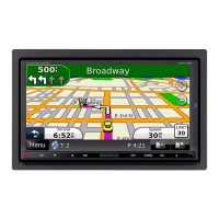
Explains how the navigation system guides you along the route using maps, voice prompts, and arrows.
Instructions on how to find a destination by entering its address, including city and street details.
Method for finding locations by interacting directly with the map display and reviewing points of interest.
Details on interpreting the information page for a selected location, including options like Go To or Advanced.
How to retrieve a list of the last 50 places that were found or searched for.
Techniques for searching for locations in areas other than the current one, like different cities.
Guidance on how to narrow down search results by spelling part of the location's name.
Instructions on how to save a place you have found to your favorites or other lists.
Steps to save the vehicle's current geographical position as a favorite location.
Procedure for designating a primary location, like home, for quick access and navigation.
Guide on how to access previously saved locations, such as favorites, for navigation.
Details on how to modify saved locations, including name, location, elevation, and category.
Steps to remove saved locations from the device, either individually, by category, or all at once.
How to access and interact with the main map display, including zoom and panning functions.
Information on tracking speed, distance, time, and other trip statistics for your journeys.
How to view detailed turn-by-turn directions and arrival information for your route.
Details on viewing satellite signal strength, location data, and accessing GPS settings.
Options for managing GPS receiver behavior, including indoor use, position setting, and WAAS/EGNOS.
Step-by-step guide to creating a new route by selecting start, end, and intermediate points.
Instructions for modifying saved routes, including renaming, changing points, and adjusting preferences.
How to insert additional points or stops into an existing or newly created route.
Procedures for saving active routes, navigating saved routes, and recalculating or stopping routes.
How to add detours to avoid traffic or specific roads, and how to set up custom avoidances.
Guide to managing the track log, including recording, percentage full, and map display options.
Instructions for utilizing four different mileage logs to track travel data, including naming and activation.
Steps to purchase and activate your XM subscription to enable radio, weather, and stock features.
Guide on how to use the XM Music Player, adjust volume, change channels, and save favorites.
How to save favorite channels and artists as presets, and switch between XM1, XM2, and XM3.
Procedure to automatically scan XM Radio for saved artists and play their songs.
How to access current weather conditions, forecasts, and county warnings using XM service.
Displaying weather conditions directly on the map and managing stock quotes through the system.
Ensures the traffic module is properly connected to the KNA-G510 for traffic data reception.
How to view traffic events on the map and in a list, and understand traffic symbols and color codes.
Steps to take a detour around traffic congestion or incidents, and understand severity indicators.
Options for managing traffic subscriptions, display symbols, audio notifications, and avoidance preferences.
Procedure for subscribing to FM traffic services using a subscription code and unit ID.
Controls for system volume, mute, attention tones, touch screen tones, and keypress tones.
Settings for language, time, units, vehicle type, and safe mode operation.
Options to adjust map detail, orientation, color mode, auto zoom, route color, and dim roads.
Settings for vehicle type, route calculation preferences, off-route recalculation, and auto routing.
Viewing software details, unit ID, and restoring system settings to their original factory defaults.
Instructions for updating software, map data, and clearing all user data from the system.
How to load, find, and manage custom POIs, including proximity alerts and deletion.
Details weather data warranty, user safety responsibilities, limitations of liability, and service agreements.
Information on FCC compliance, software license agreement, and use of the remote control.
| Device Category | GPS Navigation System |
|---|---|
| Display Type | TFT LCD |
| Touchscreen | Yes |
| Map Data | NAVTEQ |
| GPS Receiver | SiRFstarIII |
| GPS Chip | SiRFstarIII |
| Bluetooth | Yes |
| Voice Guidance | Yes |
| Power Supply | 12V DC |
| Resolution | 480 x 272 pixels |
| Memory | SD card slot |
| Audio Output | Built-in speaker |
| Battery | Rechargeable lithium-ion |