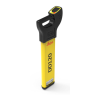
Do you have a question about the Leica Geosystems DD220 Series and is the answer not in the manual?
Directions to anticipate and avoid operational hazards.
Covers distraction, absence of indication, depth reading differences, and site securing.
Risks of clipping clamp on live utility, connecting cable, and power output.
Explains locator keys: Function, Depth Estimation, Menu, Navigation.
Details elements: Status bar, Numeric Peak Indicator, Locate Scale.
Indicates depth of buried utility or sonde.
How to navigate the locator menu and submenus.
Details main menu options: Health Check, Videos, Information, Alerts, Home.
Used with transmitter for detectability, tracing, or depth measurement.
Used with sonde for tracing pipes or blockages.
Uses visual and audible response to locate utilities.
Steps to trace a utility using peak reading and signal strength.
Confirms locator/transmitter on same utility or identifies hidden ones.
Covers large area or verifies utilities using two people.
Discovers utilities from a known point.
Steps for connecting transmitter directly to a utility.
Applies signal to cable by wrapping the cable around it.
Steps to measure utility line depth using locator and transmitter.
Steps to measure sonde depth using locator and sonde.
Measures current (mA) to identify utilities and their condition.
Status, pairing, and output options for Bluetooth.
Inspect condition, perform Audio/Visual test, and performance check.
Online verification of key circuit components and settings.
Verifies locator performance using Health Check.
Inspect condition, perform Audio/Visual and battery checks.
Verifies transmitter performance via tests and checks.
| Brand | Leica Geosystems |
|---|---|
| Model | DD220 Series |
| Category | Security Sensors |
| Language | English |