• Show Nav(igation) Aids
• Show Waypoint Names
Adjust the GMT oset hours by touching the left or right arrows.
If Daylight Saving Time is enabled in your location, touch DST En-
abled to turn it on.
Choose the clock display you prefer: 12 hour format or 24 hour format.
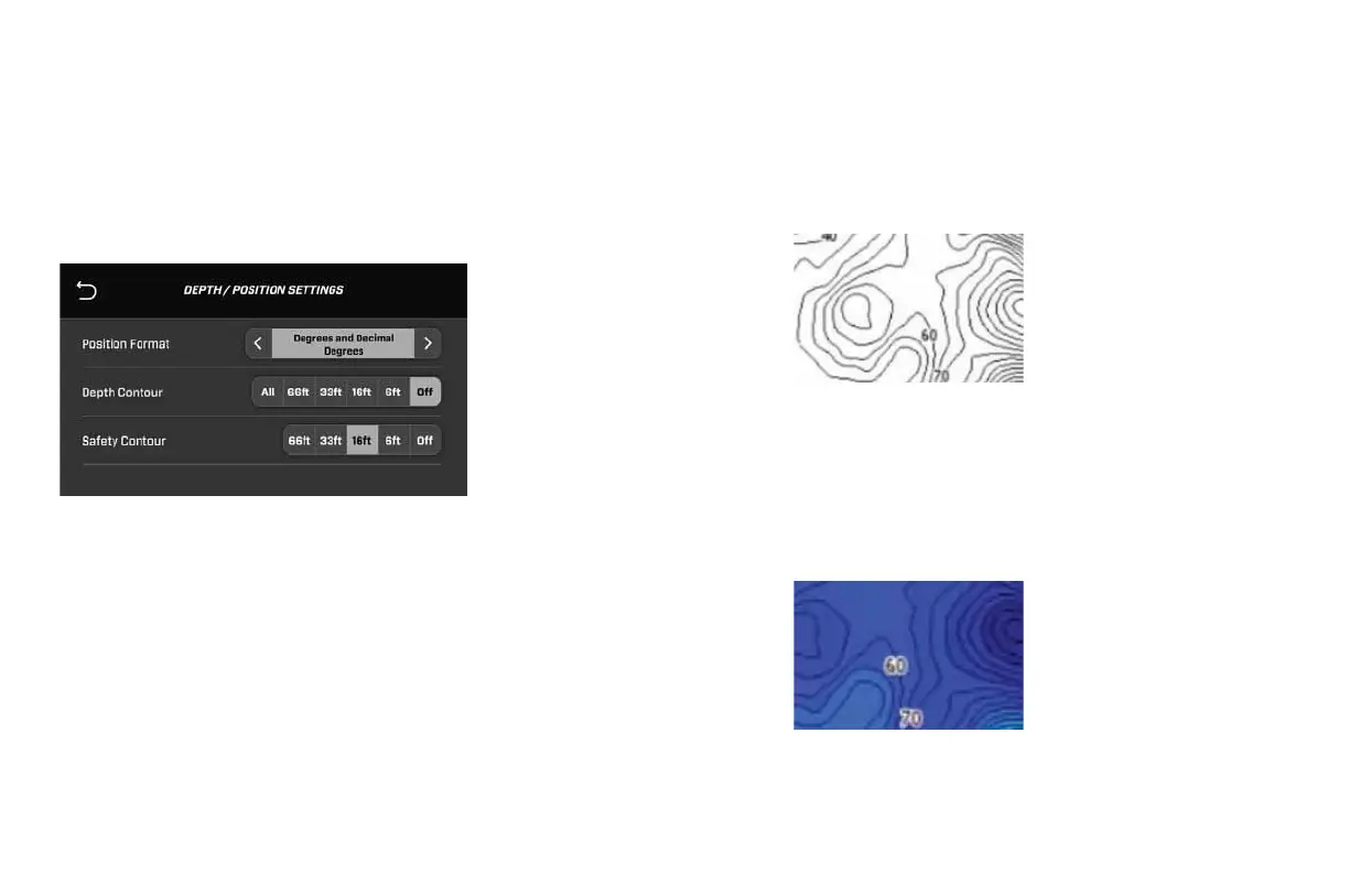
Depth / Position Settings
The Position Format selection displays positions on the map in the
following three GPS formats:
• Degrees, Minutes and Decimal Minutes (i.e., 79°58.93172W)
• Degrees, Minutes, Seconds and Decimal Seconds (i.e.,
40°20’50.93172)
• Degrees and Decimal Degrees (i.e., 79.982195)
Depth Contour
The Depth Contour setting allows an alarm to be displayed when the
boat is detecting a water depth at or above the depth selected. The
map will display depths within the lines as shown below. Choose a
Depth Contour to be displayed by touching a preferred depth:
• O
• 6 feet
• 16 feet
• 33 feet
• 66 feet
Safety Contour
The Safety Contour will change the map’s display color in areas of
water that are at or deeper than the selected depth. These depths
will be blue while depths shallower than the selected depth will
be white. Choose a Depth Contour to be displayed by touching a
preferred depth:
• O
• 6 feet
• 16 feet
• 33 feet
• 66 feet
2021MCOwnerManualFINAL.indd 109 8/26/20 1:51 PM