Page 13
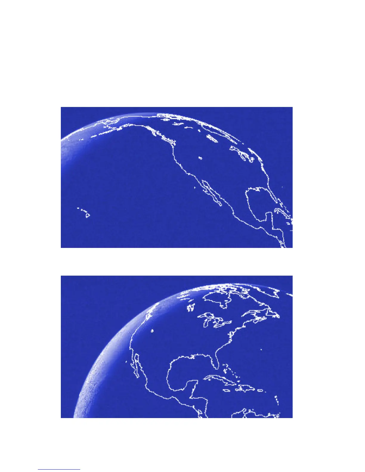
The images below show the coverage areas of the geostationary NOAA
satellites over North America. GOES-W can see the entire continent,
although the East coast is marginal; only Alaska and Hawaii are invisible
to GOES-E. Consequently, coverage overlaps over virtually all the
continental US and there is always one satellite which can see any place.
This means that a GPS-fitted PLB will have its distress position known
almost instantaneously - provided that the GPS system can determine
the position, as described on Page 10.
GOES-W
GOES-E