Do you have a question about the Navigon 20 easy and is the answer not in the manual?
Explains conventions and symbols used within the manual for clarity.
Covers liability, trademark information, and copyright notices.
Provides information on how to get support and ask questions about the product.
Details the items included in the product package and instructions for checking completeness.
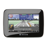
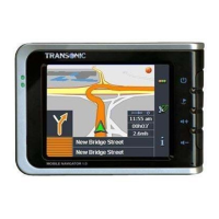
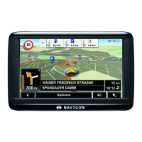
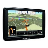
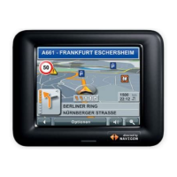
Provides a labeled diagram and description of the device's physical components and ports.
Emphasizes the need to read safety information and warnings before operating the device.
Warns against operating the device while driving and emphasizes traffic regulations.
Details precautions regarding moisture, heat, cold, and handling of the device.
Provides instructions and warnings for safely mounting the device in a vehicle.
Advises referring to safety information before using the device for the first time.
Explains how to assemble and secure the car cradle for the NAVIGON 20 EASY model.
Details the process of assembling and securing the car cradle for the NAVIGON 20 PLUS model.
Explains how to connect the car charger cable and describes charging indicators.
Describes the function and use of memory cards for storing navigation maps and data.
Explains the principles of GPS positioning and how it's used for route calculation.
States that options windows provide access to additional functions and where to find details.
Explains how to put the device into standby mode manually or automatically.
Details the procedure for completely powering down the navigation device.
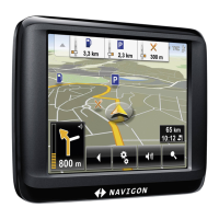
Explains symbols for GPS status and compass direction displayed on the navigation interface.
Details symbols for track recording, TMC status, and battery energy levels.
Explains the muting symbol and the behavior of the software keyboard.
Describes the on-screen keyboard, including special keys and alphabet layouts.
Explains how to enter data using the keyboard, including auto-completion and list selection.
Guides users on starting the navigation application and initializing the GPS receiver.
Explains how to specify destinations via new entry, favorites, or saved addresses.
Details how to select the destination country using the country button and flag.
Provides steps for entering address details, including city, street, and house number.
Explains how to input destination coordinates in decimal degrees or degrees, minutes, seconds.
Describes finding POIs, including nearby locations and nationwide points.
Explains how to find POIs of nationwide significance like attractions and landmarks.
Details how to search for POIs within a specific city or town.
Explains how to view nearby POIs quickly via direct access categories.
Describes how to access additional information like phone numbers for destinations.
Guides users on saving frequently visited destinations to the Favorites list.
Lists the 12 most recent destinations for quick access and re-navigation.
Explains how to import contacts from Outlook or Internet using NAVIGON Sync.
Describes how to set and navigate to a saved home address quickly.
Explains the method of selecting destinations directly from the map interface.
Shows the calculated route on the map before starting navigation, displaying flags and route details.
Explains how route profiles consider transport modes and affect route calculations and arrival times.
Allows viewing detailed driving directions for the route in a list format.
Explains how MyRoutes calculates and displays multiple route suggestions based on the profile.
Guides on selecting a route and handling traffic preview before starting navigation.
Covers saving, managing, and deleting destinations from lists like Favorites.
Provides steps to remove a saved destination from the Favorites list.
Explains how to set and enter a home address for quick navigation.
Covers planning, saving, and navigating multi-leg routes and tracks.
Explains how to set a starting point for route planning, which may not be the current location.
Guides on adding multiple destinations to a route, defining the sequence of travel.
Covers deleting route points and changing their order in a planned route.
Explains how to save, load, rename, and delete planned routes.
Details how to load previously saved routes or recorded tracks for navigation.
Explains how to calculate and view a planned route on the map, even without GPS.
Describes how to simulate navigation on a planned route, which does not require GPS reception.
Covers how to preview a calculated route and select route profiles for navigation.
Provides detailed driving directions for the route in a table format.
Explains how MyRoutes calculates and displays multiple route suggestions.
Guides on selecting a route and handling traffic preview before starting navigation.
Allows switching between 2D and 3D map views for better orientation.
Adds a specified address as a new route point to the current route plan.
Enables blocking a part of the route to calculate an alternative avoiding it.
Switches between Day and Night display modes for optimal visibility.
Removes all destinations from the current list (Favorites or Last Destinations).
Removes a single selected destination from a list.
Opens a window for finding nearby emergency services like petrol stations or hospitals.
Resets all settings to default, deleting routes and saved destinations.
Displays details about GPS reception and allows saving the current location.
Saves the selected destination as the home address for quick navigation.
Sets a point as an interim destination, guiding the user there before continuing to the original destination.
Allows notifying NAVIGON about changes to traffic systems and routing.
Shows multiple route suggestions and allows selection for continuing the journey.
Clears current route data to plan a new route.
Initiates a search for car parks near the destination for navigation.
Displays POIs along the current route and allows selection as interim destinations.
Shows hardware and software version numbers and copyright details.
Allows changing the name of a selected destination or route.
Views and changes settings for route planning based on transport modes.
Plans routes, manages saved routes, and starts navigation on a planned route.
Saves the selected address into the Favorites list.
Saves the current position under a name in the Favorites list.
Saves the planned route with a specific name.
Loads previously saved routes or tracks.
Configures the overall navigation system preferences.
Opens the map in Standard mode for viewing.
Displays the selected address on the map.
Selects and navigates predefined sightseeing tours (NAVIGON 20 PLUS only).
Simulates navigation on a planned route without GPS.
Omits the next route point, useful for multi-leg routes.
Starts or stops the recording of a track while navigating.
Opens the traffic information window showing pending reports.
Displays detailed route directions, including turns and street names.
Explains how to select and use different country maps and continent views.
Introduces the button bar providing access to map functions, including static and dynamic types.
Describes the dynamic button bar that appears on the map, activated by proximity or touch.
Explains the proximity sensor function for controlling the button bar on the NAVIGON 20 PLUS.
Details how to adjust the responsivity or disable the proximity sensor.
Describes the map view when not navigating or searching, and how it switches automatically.
Explains how to access and use options within the Standard map view.
Shows how the map displays routes before navigation starts, including MyRoutes indications.
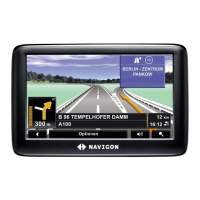
Details how the map is displayed during navigation in a vehicle, including route, speed, and junction information.
Details how the map is displayed during navigation in a vehicle, including route, speed, and junction information.
Explains current position, next junction diagrams, traffic info, and parking options.
Describes how to activate and receive pointers for NAVIGON Sightseeing sights.
Explains various map elements like speed, distance, time, and road names.
How to adjust the volume of spoken driving instructions.
Displays junction and exit information clearly for motorways.
Details navigation for pedestrians, including vertical map format and no route recalculation.
Explains map manipulation functions like zoom, pan, showing entire route, and centering current position.
Describes navigation when using a planned route with a track, similar to pedestrian mode.
Explains navigation for destinations off the digitalized road system, using offroad mode.
Details how to access and configure various map options during navigation.
Explains the procedure to safely exit the navigation mode.
Describes the map view when searching for a destination, with crosshairs and orientation.
Guides on selecting a destination on the map and using various map functions.
Explains how route profiles define transport modes and affect route calculations.
Describes predefined route profiles for different vehicle types and how to adapt them.
Guides on creating custom route profiles based on existing ones.
Explains how to choose and apply a desired route profile for navigation.
Covers editing, renaming, and deleting user-defined route profiles.
Explains how to create and import custom Points of Interest (POIs) for the device.
Details requirements for graphic files used as symbols for custom POIs.
Guides on transferring custom POIs and symbols to the device using NAVIGON Fresh.
Explains how to enable and create screenshots of the device's screen.
Describes how to activate the screenshot function and the appearance of the button.
Explains how to capture and save the current screen content.
Covers recording, saving, and playing back tracks in KML format.
Details how to stop the recording of a track and where it is saved.
Explains loading saved tracks for route planning and navigation.
Guides on using the parking function when approaching a destination.
Covers parking scenarios: continuing on foot, searching for car parks, and returning to destination.
Shows POIs, favorites, and traffic info from the current map view in a list.
Allows stipulating POI categories to display along the route for interim destinations.
Explains how to display and view details of POIs lying along the current route.
Guides on navigating to a selected POI, setting it as an interim destination.
Allows stipulating up to 3 POI categories to be displayed for the POI on Your Route function.
Explains how to activate and configure pointers for NAVIGON Sightseeing sights.
How to view details of NAVIGON Sightseeing sights, including address and opening hours.
Describes predefined routes of scenic, cultural, or touristic interest.
Helps find nearby emergency services like petrol stations or hospitals and navigate to them.
Views GPS status and saves the current location as a favorite.
Blocks a section of the route to force recalculation of an alternative path.
Displays detailed route directions before or during navigation, allowing route section blocking.
Explains how TMC provides traffic updates and allows previewing traffic messages.
Shows how to view current traffic information, including message types and obstruction severity.
Explains how to view detailed information for a specific traffic message and its map display.
Configures TMC traffic station, tuning mode, and route recalculation preferences.
Lists detailed specifications of the navigation device, including dimensions, weight, and components.
Outlines the terms and conditions for using the NAVIGON software and its licensing.
States that the device conforms to EU directives and provides a link to view the declaration.
Provides solutions for issues related to connecting the device to a charger or computer.
Offers steps to reset the device when the screen is frozen or it becomes unresponsive.
Suggests settings to minimize energy consumption and prolong battery life.
Explains how to disable demo mode if it was accidentally activated during initial setup.
| Display Size | 3.5 inches |
|---|---|
| Display Type | TFT |
| Screen Resolution | 320 x 240 pixels |
| Battery Life | Up to 2 hours |
| Touchscreen | Yes |
| GPS | Yes |
| Lane Guidance | Yes |
| Speed Limit Display | Yes |
| Text-to-Speech | Yes |
| GPS Receiver | High-sensitivity |