Do you have a question about the Pioneer avic-u280 and is the answer not in the manual?
Guidance on safe listening levels to protect hearing.
Steps to set a safe listening volume.
General rules for safe listening and use.
Warning about headphone use while driving.
Legal terms and conditions for using the software.
License agreement specific to USA.
License agreement specific to Canada.
Information about map data limitations and updates.
Warnings and precautions for safe operation.
Instructions for using the SD card slot.
General notes before system operation.
Information on accessing Pioneer's website for support.
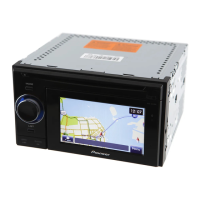
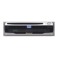
Identification of product components and their functions.
Step-by-step guide for inserting an SD card.
Instructions for resetting the device's microprocessor.
Initial setup process for the navigation system.
Steps for starting the navigation system normally.
Overview of how to navigate between different screens.
Explains functions available within different menus.
How to navigate and interact with list-based screens.
Guide to using the virtual keyboard for input.
How to check the GPS signal strength and status.
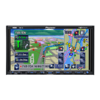
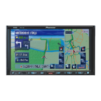
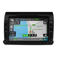
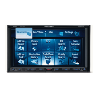
Explanation of map display elements and icons.
Icons and meanings for common route events.
How to locate and display the vehicle's current position.
Accessing detailed information about the current location.
How to view and interpret data fields during navigation.
Information displayed during freeway navigation.
General operations for interacting with the map screen.
How to zoom in and out on the map.
Explanation of the automatic zoom feature.
Adjusting the map's perspective and tilt.
How to toggle between 2D and 3D map views.
Manual navigation of the map display.
How to get details about points of interest on the map.
Step-by-step guide to finding locations using addresses.
How to find a location using a street midpoint.
How to find a location by specifying the city center.
How to locate a place using its ZIP code.
Methods for finding points of interest.
Using quick search for finding places by name.
Searching for POIs via predefined categories.
Searching POIs by selecting specific categories and subcategories.
Finding POIs by typing their names.
How to find points of interest near your current location.
Using the map to visually select a destination.
Accessing previously saved locations.
How to find locations from your search history.
Accessing recently visited destinations for quick routing.
Viewing a list of past destinations.
Finding a location using latitude and longitude.
Selecting a destination by manually panning the map.
How to establish a route to a chosen destination.
Steps to set a route after finding a location.
Reviewing different route options before starting.
Creating routes using the My Route feature.
Viewing the entire planned route.
Reviewing and interacting with route details and options.
Adjusting how routes are calculated.
Setting the vehicle profile for route planning.
Configuring vehicle-specific settings for routing.
Defining parameters for route calculation.
Selecting which road types to include or exclude.
Overview of ways to change an active route.
Adding or changing destinations with an active route.
Changing the route's origin point.
Modifying the sequence or content of destinations.
How to stop active route guidance.
Comparing alternative routes for the current journey.
Running a simulated navigation of the planned route.
Instructions for using off-road navigation mode.
Saving frequently used locations for quick access.
Setting up points that trigger warnings (e.g., speed cameras).
Modifying previously saved alert points.
Accessing past traffic data for route planning.
How to get live traffic updates via TMC.
Viewing traffic incidents directly on the map display.
How to access the main settings menu.
Adjusting audio settings, including volume and voice.
Personalizing shortcuts for frequently used functions.
Creating and managing profiles for multiple users.
Adjusting map appearance, colors, and display elements.
Configuring how route information is displayed.
Adjusting screen animations and brightness.
Setting language, units, and time formats.
Configuring trip logging and data saving.
Re-running the initial setup process.
Restoring the system to its factory default configuration.
Accessing various options and additional applications.
Configuring program settings and behavior.
Obtaining new maps, applications, and updates.
Converting between different international units.
Converting clothing and shoe sizes.
Monitoring car fuel usage and setting reminders.
Viewing sunrise and sunset times for locations.
Managing saved trip logs and track logs.
Accessing driving information for different countries.
Using the scientific calculator for calculations.
Accessing product information, demos, and license agreements.
Crucial safety warnings regarding installation.
Safety advice before making electrical connections.
General precautions before starting the installation process.
Warnings to avoid damaging the product or vehicle.
Detailed safety considerations before installing.
Wiring diagram and instructions for connecting components.
Method for physically mounting the unit using fasteners.
Explanation of how GPS positioning works.
How GPS satellites are used for location determination.
Methods used to minimize positioning errors.
Conditions that prevent GPS positioning.
Factors that can lead to inaccurate GPS readings.
Information on how routes are calculated by the system.
Built-in rules and logic for route calculation.
Trademark information for SD and SDHC cards.
Page references for various menu items and functions.
Definitions of key terms used in the manual.
Technical details and specifications of the product.
| Resolution | 800 x 480 pixels |
|---|---|
| GPS Navigation | Yes |
| Audio Formats Supported | MP3, WMA, AAC |
| USB Port | Yes |
| SD Card Slot | Yes |
| Touchscreen | Yes |
| CD Player | No |
| DVD Player | No |
| Rear View Camera Input | Yes |
| HD Radio | No |
| SiriusXM Ready | Yes |
| AM/FM Tuner | Yes |
| Voice Control | No |
| Bluetooth | Yes |
| Video Formats Supported | MPEG-1, MPEG-2, DivX |
| iPod/iPhone Compatibility | Yes |
| Android Compatibility | Yes |
| Display Size | 6.2 inches |