Do you have a question about the Rand McNally intelliroute TND 720 and is the answer not in the manual?
Covers FCC and IC statements regarding device operation and compliance.
Provides details about GPS technology and customer support contact information.
Covers important safety information, included items, charging, and mounting procedures.
Describes device ports and the procedure for initial power-on.
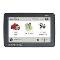
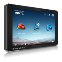
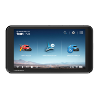
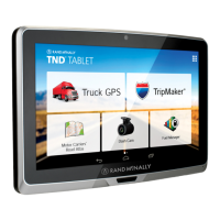
Explains the main menu interface and its primary navigation options.
Covers screen, keyboard, language, units, and clock settings.
Details truck specifics like weight/dimensions and warning configurations.
Configures route calculation options including avoidances and tolls.
Adjusts map display settings, POI icons, and route color.
Manages driver hours, odometers, and activity logs.
Accessing the different options for entering destination information.
Provides tips for entering and searching for addresses efficiently.
Steps for routing to addresses, city centers, intersections, or coordinates.
Organizing saved locations, creating groups, and managing custom POIs.
Creating, editing, reordering, and running routes with multiple destinations.
Searching for and filtering nearby services, truck stops, and amenities.
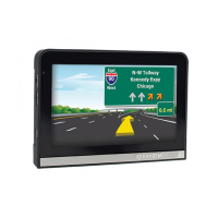
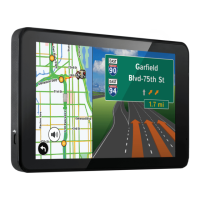
Explains the main navigation map interface and its elements.
Details turn-by-turn directions, exit information, and street names.
Displays real-time speed, elevation, and trip status information.
Explains lane assistance, detour options, and skipping route segments.
Connecting to wireless networks for updates and data access.
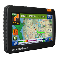
Accessing current and forecast weather data for locations.
Accessing specific utilities for truck operations like timers and planners.
Utilizing traffic data for route adjustments and avoiding delays.
Using the Dock software for device management, updates, and features.
Uploading and managing user-defined locations and alert points.
Transferring travel data, like mileage and fuel purchases, to a computer.
Sending feedback, suggestions, or incident reports to Rand McNally.
Information on registered trademarks and content copyrights.
| Screen Size | 7 inches |
|---|---|
| Screen Resolution | 800 x 480 pixels |
| Weight | 13.6 ounces |
| Truck Routing | Yes |
| Bluetooth | Yes |
| Wi-Fi | Yes |
| GPS | Yes |
| Speaker | Yes |
| SD Card Slot | Yes |
| Internal Storage | 8 GB |
| Expandable Storage | Yes, via SD card |
| Battery | Rechargeable lithium-ion |
| Preloaded Maps | Yes |
| Lifetime Map Updates | Yes |
| Lifetime Traffic Updates | Yes |
| Voice Command | Yes |
| Maps | Rand McNally Maps |