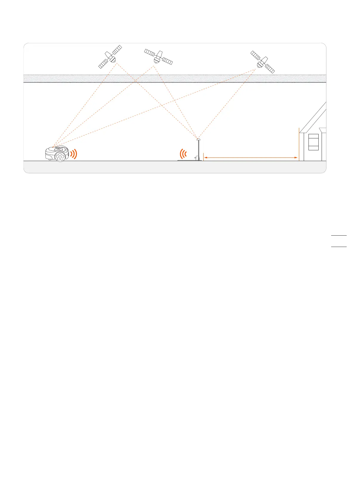
EFLS (Exact Fusion Locating System) is Navimow's unique high-precision localization technology. Based on satellite positioning, EFLS technolo-
gy integrates various sensor data to improve positioning accuracy and fault tolerance through algorithm fusion.
The mower can locate itself through satellite signals, which can also be picked up by the antenna. By comparing the satellite signals from the
antenna and the mower, errors in the transmission of the signal (such as the offset of the satellite signal as it travels through the ionosphere)
can be minimized, improving satellite positioning accuracy to the centimeter level.
In addition, the data collected by the gyroscope, accelerometer, magnetic compass, and odometer sensors can also be integrated into this
system through Navimow's data fusion algorithms, further improving the applicability of Navimow to various environments.
EFLS 2.0, combined with VSLAM (visual simultaneous localization and mapping) technology, is another step toward to a more accurate position-
ing. In a yard where bushes and tall trees may be blocking the GPS signal, or where the antenna is installed close to houses, positioning can be
inaccurate. With the help of from EFLS 2.0, you will get a precise work area in these complex outdoor environments without laying boundary
wires, and the mowing paths are optimized through algorithms in the work area to achieve planned mowing results and maximize the mower's
work efficiency.
By integrating data collected from the camera sensor, EFLS 2.0 can reduce errors and inaccuracies caused by poor GPS signal. During mapping,
the lawnmower uses its camera to capture key features of the environment like houses and trees. It builds a visual map from these features and
stores them digitally. Later, when it reaches a familiar location, the lawnmower can locate itself by comparing current images to features stored
in the map. Unlike satellite signals which can be blocked, a visual map works anywhere. As it cuts more, the lawnmower adds more visual
information to the map. This increases coverage and allows it to update the map if the environment changes. Over time, an up-to-date visual
map improves the lawnmower's ability to locate itself. For instructions on mapping and using EFLS 2.0 featuresv to improve positioning
accuracies, see 2.6 Map out the Work Area.
lonosphere & troposphere lonosphere & troposphere
≥ 2m

 Loading...