Do you have a question about the Skywatch Geos N11 and is the answer not in the manual?
Guidance on locating information and understanding symbols used in the manual.
Details on the instrument's development and quality.
Crucial safety warnings and liability disclaimers for instrument use.
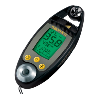
Detailed identification and description of the instrument's physical parts.
Lists all available measurement functions, including wind, temperature, pressure, and humidity.
Explains the different blocks (upper, large, middle, lower) of the display.
Details on how to select and switch between measurement modes on the screen.
Step-by-step guide for initial instrument setup, including date and time settings.
Describes instantaneous, normal states, and how to switch the instrument off.
Details on using the SEL button for block selection and navigation.
Explains how to control the screen backlight using the LUM button.
Details on using the MOD button to change displays and settings.
Describes how to view instantaneous, maximum, and average wind speeds.
Procedure to reset max wind speed and change measurement units.
Explains temperature and windchill measuring modes and unit selection.
Describes relative humidity and dew point measuring modes.
Overview of pressure, altitude, QFE, and flight level modes.
Procedure for calibrating the altitude based on air pressure.
How to reset maximum altitude and QFE height values.
Guide to selecting pressure units and calibrating relative pressure (QNH).
Describes the bargraph and digital display options for the compass.
Instructions and recommendations for calibrating the compass.
Explanation of Flight Level and overview of special modes.
How to access and use the special menu for settings and modes.
How to view and calibrate the instrument's date and time settings.
Explains how barometric tendency is displayed and interpreted.
How to use and view the chronometer for timing measurements.
Explains the display of density altitude and how to change related modes.
Describes the magnetic field measurement and its relation to compass accuracy.
How to adjust magnetic declination for true North compass readings.
Explains the variometer's display of ascent/descent rate and unit selection.
Describes finesse for gliding performance and its display format.
Details the instrument's memory capacity and the three types of memories available.
Instructions on how to manually record sensor data.
How to set and view automatic recordings at configurable rates.
Describes the history memory and how data is recorded.
Explains different states like Storage, OFF, Automatic Stop, Permanent operation.
Details on the instrument's storage and OFF states.
How the automatic stop feature works and how to adjust its timer.
Instructions for setting the instrument to permanent operation.
How to transfer recorded data to a computer using the interface.
Procedures for resetting memories and screen configurations.
Steps for performing a general reset or a full instrument reset.
Detailed guide on replacing the main instrument batteries.
Instructions for replacing batteries in the LED lamp.
Steps to test all segments of the LCD display.
How to correct deviations in the instrument's clock.
Procedure for calibrating the pressure sensor, reserved for professionals.
Details on measurement precision and display resolution for various parameters.
Details on the warranty period, what is covered, and how to make a claim.
| Device | Skywatch Geos N11 |
|---|---|
| Category | Measuring Instruments |
| Temperature range | -20°C to +60°C |
| Temperature resolution | 0.1°C |
| Compass resolution | 1° |
| Barometer resolution | 0.1 hPa |
| Battery life | Several months |
| Water resistance | IP67 |
| Operating Temperature | -20°C to +60°C |
| Data Logging | Yes |
| Wind speed range | 0 to 150 km/h |
| Barometer range | 300 to 1100 hPa |
| Measurement Range | Varies by parameter |
| Accuracy | Varies by parameter |
| Resolution | Varies by parameter |
| Response Time | Varies by parameter |
| Communication Interface | Bluetooth |