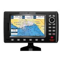
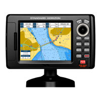
Do you have a question about the Standard Horizon CPF390i and is the answer not in the manual?
Locating nearest port services based on vessel position.
How to find the nearest ports to your vessel's location.
Locating nearest tide stations and viewing tide graphs.
Finding the nearest wrecks to your vessel's position.
Information about the pre-loaded coastal navigation charts.
Details on the areas and features covered by built-in charts.
How to update the built-in charts with new data.
Instructions for inserting the MAX C-CARD for chart data.
Accessing the menu for maximum map functions.
Setting the chart zoom method (Standard or Flexi-Zoom).
Adjusting the size of icons displayed on the charts.
Changing the size of place names displayed on the charts.
How to create a new mark directly from the chart page.
Modifying existing marks, including position, name, and icon.
Procedure for deleting stored marks or waypoints.
How to reposition existing marks or waypoints.
How to mark the current position as a MOB point.
Procedure for removing a MOB point.
Step-by-step guide to creating a route using waypoints.
How to name or rename a created route.
Creating a route where the starting point is the final destination.
Creating more than one route.
How to create a route using existing marks on the chart.
Adding a waypoint into an existing route.
Setting navigation to a selected route.
Procedure to select and start navigation to a route using the GOTO function.
Using the ShuttlePoint knob to follow a route.
Steps to remove a route from the system.
Function to check routes for potential navigation hazards.
Functionality for recording the vessel's path.
Steps to save and start recording a new track.
Procedure for removing a recorded track.
Additional settings related to track recording.
Using the trip log feature to record journey data.
Accessing the menu for managing the User C-CARD.
Steps to format the User C-CARD for use.
How to copy data to the User C-CARD.
Restoring data from the User C-CARD.
Removing files from the User C-CARD.
Updating the User C-CARD with new information.
The primary page for viewing navigation charts.
Using the Focus soft key to switch between chart windows in dual mode.
Displaying a single chart view.
Options for selecting different data window layouts.
Modifying the data fields displayed in various windows.
Features like icons for buoys, lights, and ports on the chart.
Controlling the display of information pop-ups for chart icons.
Selecting pre-programmed display modes for cartographic objects.
Controlling the display of marine features on the chart.
Adjusting depth range settings for chart display.
Controlling the display of terrestrial features on the map.
Settings that control how chart features are displayed.
Controlling the display of underwater objects on the chart.
Showing a 3D view of the vessel during navigation.
Displaying tide and moon phase information.
Viewing information about GPS satellite reception status.
Enabling or disabling WAAS/EGNOS differential correction.
Accessing and configuring GPS setup options.
Displaying information from external NMEA devices.
Viewing raw NMEA data transmission from devices.
Displaying trends for depth, temperature, and speed.
Functionality for establishing VHF radio calls using DSC.
Connecting the chart plotter to a DSC VHF radio.
Displaying and logging DSC distress calls.
Displaying and logging DSC position requests.
Configuring NMEA, AIS, and RADAR input/output settings.
Setting up ports for receiving data from various devices.
Configuring ports to send NMEA sentences to other devices.
Customizing coordinate systems, chart datum, and static navigation.
Setting up audible and visual alarms for arrival, XTE, depth, and grounding.
Using the simulator to practice navigation operations.
Enabling or disabling features related to DSC calls.
Definitions of terms related to AIS targets and alarms.
Configuring the GPS Chart Plotter to receive AIS data.
Setup options for the AIS system.
Displaying quick information about AIS targets.
Showing the AIS List page for target ship information.
Explaining the color coding of AIS targets.
Accessing the C-Weather service menu.
Downloading weather data via C-COM.
Loading C-Weather data from the User C-CARD.
Selecting specific weather data layers for display.
Viewing weather data at the current date and time.
Selecting the type of weather data to display.
Connecting the MOBILARM system to the GPS Chart Plotter.
Setting up the GPS Chart Plotter to communicate with MOBILARM.
Checking the communication status of the MOBILARM system.
Information about the MOBILARM PTX personal transponder.
How the system reacts when a MOB alert is received.
How to interact with the PTX icon on the chart page.
Removing a PTX icon from the chart and alarm list.
Navigating to the position of a received PTX icon.
Viewing the list of all received MOBILARM alarms.
How to enable or disable the internal Fish Finder.
Explanation of the elements and readings on the Fish Finder display.
Detailed explanation of the Fish Finder display elements.
How to select and view different Fish Finder display pages.
Automatically adjusts transmit frequency based on depth.
Viewing full screen or split screen Fish Finder displays.
Zooming into specific areas of the Fish Finder display.
Displaying chart and Fish Finder information side-by-side.
Displaying radar information.
Displaying chart, Fish Finder, Radar, and Highway pages together.
Managing focus between multiple windows on combo pages.
How to operate the soft keys for Fish Finder functions.
Accessing the Fish Finder setup menu.
Using pre-configured settings for Fishing or Cruising.
Selecting the Fish Finder's transmit frequency.
Setting the receiver gain to Auto or Manual.
Adjusting the range settings for the Fish Finder display.
Selecting between Manual, Auto Range, and Bottom Lock.
Filtering out noise from other sonar devices.
Adjusting sensitivity settings for the Fish Finder.
Adjusting receiver sensitivity from 0 to 100%.
Attenuating echoes from surface down to a specified depth.
Setting the depth range for STC operation.
Adjusting the attenuation value of the STC function.
Dynamically removing surface clutter from the display.
Customizing the appearance of the Fish Finder display.
Changing the color scheme of the Fish Finder display.
Controlling the update rate of the Fish Finder display.
Adjusting how bottom type (hard/soft) is displayed.
Controlling the graphical representation of underwater targets.
Displaying real-time echoes from the bottom.
Calibrating speed, temperature, and offset settings.
Setting depth offset relative to the keel or transducer.
Calibrating water speed readings from the transducer.
Calibrating the water temperature sensor.
Defining alarm settings for shallow water, depth, and temperature.
Triggering an alarm when depth becomes shallower than set.
Triggering an alarm when depth becomes deeper than set.
Setting alarms based on detected fish size.
Triggering an alarm when temperature exceeds a set point.
Triggering an alarm when temperature drops below a set point.
Triggering an alarm on rapid temperature changes.
Saving Fish Finder settings to a User C-CARD.
Loading Fish Finder settings from a User C-CARD.
Restoring default values for current presets.
Running an extended auto-test to diagnose problems.
Verifying memory integrity and resetting defaults.
Adjusting screen brightness and keypad backlight.
Checking the C-CARD and its connector.
Testing and configuring serial port parameters.
Detailed specifications including power, interface, and display.
Technical specifications for the CPF390i's Fish Finder.
Physical dimensions of the CP390i and CPF390i units.
Specifications for the optional FF525 Fish Finder.
Specifications for the optional WAAS GPS Receiver.
| Resolution | 240 x 320 pixels |
|---|---|
| Sonar Frequency | 50/200 kHz |
| Power Output | 600W RMS |
| Waterproof Rating | IPX7 |
| Depth Capability | Up to 1000 feet |
| Transducer | Included |
| Display Type | TFT LCD |
| Operating Temperature | -15°C to +55°C |
| GPS | Built-in GPS/WAAS receiver |