Do you have a question about the ViaMichelin X-970 and is the answer not in the manual?
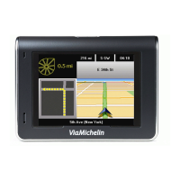
Details the various buttons and sockets on the ViaMichelin Navigation X-970 device.
Provides step-by-step instructions for mounting the device in a vehicle.
Guides users through inserting the SD card and initial software setup.
Explains how to activate and acquire GPS signals for the navigation system.
Outlines methods for selecting a destination for navigation.
Guides users on how to search for destinations by address.
Details the process of searching for a destination using a zip code.
Guides users on searching for destinations by town and state.
Explains how to search for Points Of Interest (POI) as destinations.
Guides users on searching for POIs within a specific town.
Details how to search for POIs using specific criteria and keywords.
Guides users to find POIs based on GPS position or travel points.
Describes how to select a destination directly on the map.
Explains how to access and manage saved routes, addresses, and POIs.
Details how to use saved favorites and personal folders for navigation.
Guides users on accessing and using saved Points Of Interest.
Explains how to view and select from the history of recent destinations.
Describes how to enter destination coordinates manually.
Explains how to use the device for navigation without a pre-set route.
Guides users through the process of planning a route with departure and arrival points.
Details how to plan a route by specifying an address.
Explains how to plan a route by selecting a Point Of Interest.
Describes how to plan a route by selecting points directly on the map.
Guides on using saved items from My ViaMichelin to plan routes.
Explains how to use past destinations from history to plan a route.
Details how to use GPS coordinates to plan a route.
Allows selection of navigation modes like Car, Pedestrian, or Bicycle.
Lets users choose route types like Recommended, Quickest, or Shortest.
Explains how to authorize or avoid toll roads in route calculation.
Describes how to display the map and access map options.
Guides users on configuring map display settings like search and telephone.
Details the different search modes available within map options.
Explains how to save the current location marker's position.
Covers telephony options accessible through map settings.
Guides on configuring display settings for map elements.
Explains how to display saved addresses from My ViaMichelin on the map.
Details how to display Points Of Interest on the map.
Describes how to center the map on departure, arrival, or the route.
Outlines operations for managing calculated routes, like adding stages.
Guides on adding intermediate stages to a planned route.
Explains how to delete a previously calculated route.
Details how to show or hide driving direction instructions on screen.
Guides on viewing route summaries and maps.
Explains how to start GPS-guided navigation.
Describes how to search for Points Of Interest using various methods.
Details how to save and manage favorite addresses, routes, hotels, etc.
Explains how to save, start, rename, or delete favorite routes.
Guides on searching, adding, or displaying addresses.
Describes how to find addresses near the current GPS position.
Guides on finding POIs to add to addresses and how to add them.
Details how to toggle the display of POIs on the map.
Guides on enabling/disabling audible warnings for POIs.
Explains functionalities for managing favorite hotels.
Guides on managing favorite restaurants.
Explains how to manage favorite tourist sites.
Describes how to manage custom POIs downloaded from websites.
Outlines actions for displaying POIs or enabling warnings.
Accesses the ViaMichelin web account for data management and sharing.
Direct link to the ViaMichelin website for further information.
Guides on exporting addresses and routes to the PND.
Covers general system settings like language, units, and keyboard.
Allows adjustment of interface, voice, and map languages.
Lets users select distance units (km or miles).
Guides on selecting the keyboard layout for search screens.
Provides access to power status, time, and brightness settings.
Displays the current battery charge level.
Allows adjustment of the system time and display format.
Guides on adjusting the screen brightness level.
Explains how to switch between day and night display modes.
Provides information about the software version and copyrights.
Allows adjustment of route calculation, GPS, and voice settings.
Allows configuration of route calculation criteria like mode, type, and tolls.
Displays GPS signal status and acquisition information.
Settings for voice guidance and speech output.
Controls volume for alerts, voice guidance, and telephone.
Provides settings for Bluetooth, phone connection, and sound.
Guides on enabling and disabling Bluetooth connectivity.
Explains the process of connecting a mobile phone via Bluetooth.
Allows adjustment of telephone volume and ring tone.
Covers changing, deleting maps, and displaying POIs.
Guides on changing or deleting map systems from the SD card.
Explains how to select which POIs are displayed on the map.
Guides on deleting POI categories from the SD card.
Allows selection of saved addresses to display on the map.
Covers settings for speed, POI, and saved address warnings.
Explains how to set speed warnings based on road types.
Guides on enabling audible warnings for nearby POIs.
Details how to set audible warnings for saved addresses.
Explains how to control audible signals for speed cameras.
Allows configuration of sounds for various warning types.
Describes the screen layout combining map and schematic views.
Details the information displayed on the map screen.
Shows remaining distance, time to arrival, and current time/speed.
Describes the schematic diagram for upcoming route changes.
Explains how to use the device for navigation without a planned route.
Shows a summary of the calculated route and allows changes.
Accesses telephony options during navigation.
Navigates to sound settings for alerts and guidance.
Accesses various navigation options like alerts and traffic info.
Covers settings for screen type, night mode, and POI display.
Allows selection of screen types: Schematic, Map, or Mixed.
Guides on adjusting screen brightness for day or night driving.
Explains the difference between 2D and 3D map views.
Details how to display Points Of Interest on the map.
Guides on displaying saved addresses from My ViaMichelin.
Explains how to enable or disable automatic map zooming.
Guides on how to find and view detailed descriptions of Points of Interest.
Shows symbols used for Michelin Green Guide POIs.
Details the contents and structure of the supplied SD card.
Guides on inserting the SD card into the PND.
Lists the programs and files included on the DVD-ROM.
Provides instructions for installing software from the DVD-ROM.
Guides on installing the necessary ActiveSync software for PC communication.
Guides on installing drivers for Windows 2000 to connect the PND.
Guides on installing drivers for Windows XP to connect the PND.
Guides on installing and activating the navigation software on a PC.
Guides on adding new map sets or repairing existing installations.
Details how to repair an existing software installation.
Explains how to uninstall the navigation software from a PC.
Manages personal data like addresses, POIs, and routes via PC.
Guides on creating new folders for organizing personal data.
Details how to modify existing personal folders, including name and color.
Explains how to delete personal folders and their contents.
Guides on changing address names or adding comments.
Details how to delete specific addresses from folders.
Accesses the ViaMichelin web account for data management and sharing.
Guides on exporting addresses and routes to the PND.
Manages Michelin and Thematic POIs for export to the PND.
Guides on exporting Michelin POIs and Green Guide tourist sites.
Explains how to export POIs organized by theme.
Guides on adding external POI files from partner websites.
Explains adding addresses or routes from the ViaMichelin website.
Guides on adding custom saved address files.
Explains how to create custom saved address files.
Guides on creating custom icons for saved addresses.
Explains the synchronization process between PC and PND.
Provides help for common issues like FAQ, updates, and restoring data.
Guides on accessing FAQs and software updates.
Explains how to download the user manual.
Guides on regenerating the SD card to factory settings.
Guides on restoring the PND to its original factory settings.
Lists the minimum PC requirements for installing the software.
Provides detailed technical specifications of the navigation device.
Outlines the terms and conditions for using the software.
Specifies which software and data are covered by the agreement.
Grants a limited, non-exclusive license for software and data use.
States copyright and intellectual property rights for the software.
Details limitations and prohibitions on software usage.
Defines the duration and termination conditions of the agreement.
Addresses the validity of provisions if any part is found invalid.
Specifies the governing law and jurisdiction for sales agreements.
Outlines the warranty terms for the navigation device and its components.
Details the warranty period and conditions for hardware defects.
Covers the warranty period and compliance for the navigation software.
Lists exclusions and limitations of the product warranty.
Describes the remedies available in case of hardware or software defects.
Explains how to implement the warranty by contacting the retailer.
Lists specific exclusions from the warranty coverage.
Limits ViaMichelin's responsibility for damages and indirect losses.
Addresses the validity of provisions if any part is found invalid.
Specifies the governing law and jurisdiction for the warranty agreement.
| Brand | ViaMichelin |
|---|---|
| Model | X-970 |
| Category | GPS |
| Language | English |