English – 10
calculation of the topographic range extends to no more than
100km.
If you have imported or planned GPX routes via the online
portal, these will be transferred to your Nyon via Bluetooth®
or via a Wi-Fi connection. You can start these routes when
you wish. If you are near a route, you can have the navigation
system guide you to the starting point or you can start navig-
ating along the route immediately.
At temperatures below 0 °C, the elevation measurement is
likely to deviate significantly.
Active Navigation
The following figure shows an example active navigation with
explanations of the symbols depicted.
n12
n11
n13
n14
n15
n16
n19
n18
n17
n11
Distance to destination
n12
Time of arrival
n13
Destination
n14
Current position
n15
Battery range indicator
n16
End active navigation
n17
Open and close panel (back to search)
n18
Switch between 2D and 3D view
n19
Centre view (back to current position)
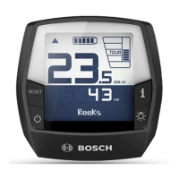
<Trip Data Screen>
i <Trip Distance>
Trip distance indicator
m <Trip Time>
Trip time indicator
n <Avg. Speed>
Average speed indicator
o <Altitude>
Altitude above sea level indicator
<Analysis Screen>
p <Riding Mode Usage>
Indicator for usage of different riding modes
q <Max. Speed>
Maximum speed indicator
r <Ascent>
Ascent indicator
1 270 020 BN2 | (18.03.2020) Bosch eBike Systems
 Loading...