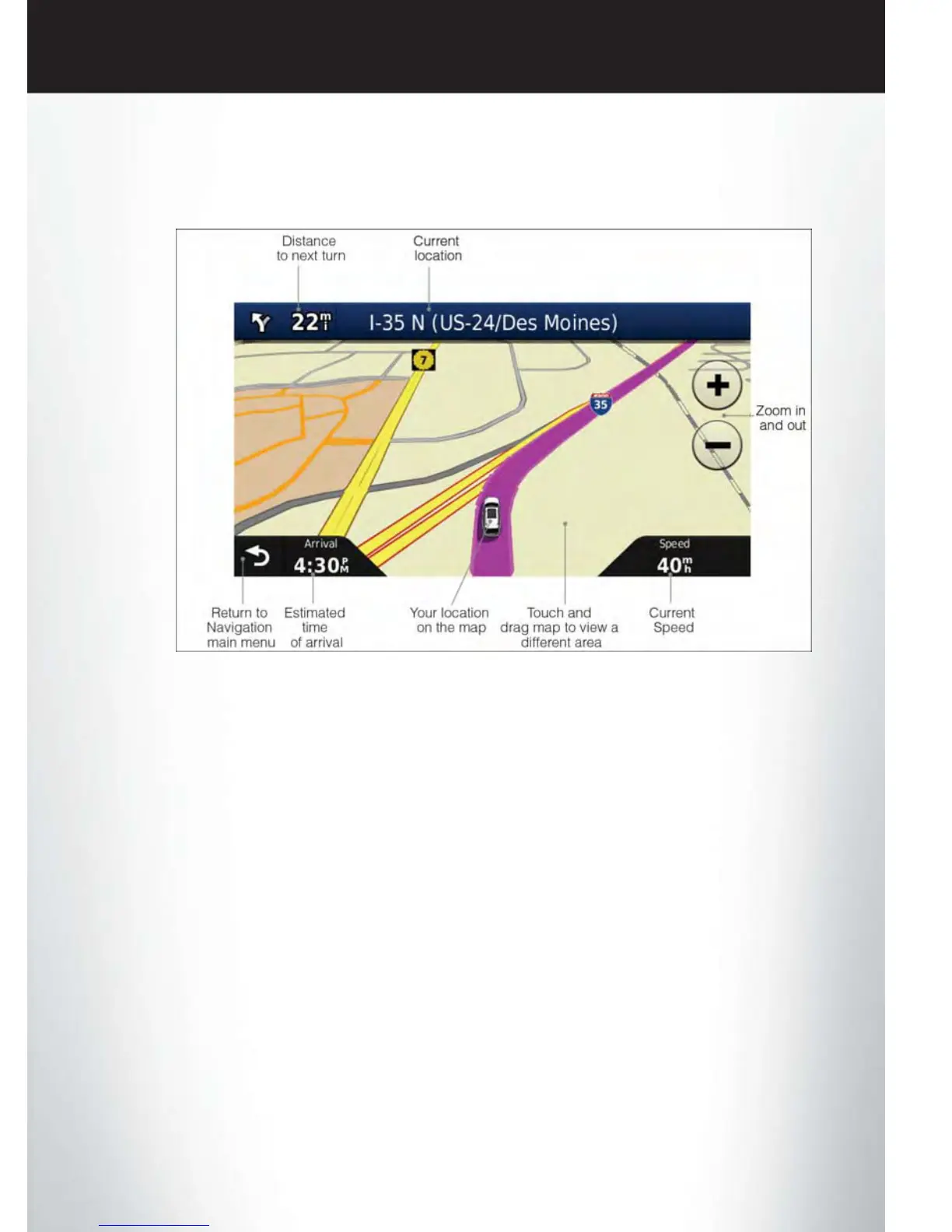
Following Your Route
• Your route is marked with a magenta line on the map. If you depart from the original route,
your route is recalculated. A speed limit icon could appear as you travel on major roadways.
Adding A Via Point
• To add a stop between the current location and the end destination (Via Point) you must be
navigating a route.
• Touch the “back arrow” icon multiple times to return to the Main Navigation menu.
• Touch the “Where To?” soft-key, then search for the additional stop. Select the Via Point you
wish to add from the given search results.
• Touch the “Go” soft-key, then touch the “Add to Current Route” soft-key.
Taking A Detour
• To take a detour you must be navigating a route.
• Touch the “back arrow” icon soft-key multiple times to return to the Main Navigation menu.
• Touch the “Detour” soft-key.
NOTE:
If the route you are currently taking is the only reasonable option, the device might not calculate
a detour.
Acquiring Satellites
• The GPS Satellite strength bars indicate the strength of your satellite reception.
• Acquiring satellite signals can take a few minutes. When at least one of the bars is green, your
device has acquired satellite signals.
• You may experience delays receiving satellite signals when in areas with an obstructed view to
the sky, such as garages, tunnels, or large cities with tall buildings.
ELECTRONICS
39