Page 3 of 7
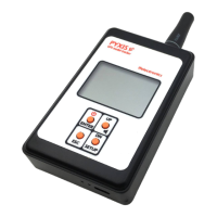
PYXIS Beacon
Positioning
Position the beacon with the radio antenna wire vertical out of the top of the pylon. If the pylon is
made of conductive material (e.g. carbon), the narrower upper part of the beacon (approximately
4.5mm high) should protrude completely from the top of the pylon outline.
Bottom side LED indications
The green and red LEDs visible on the bottom side of the beacon provide various indications. The
red LED goes shortly on during the beacon transmission. The green LED indicates the status of the
GPS (flashing = GPS acquisition, solid = GPS connected / locked, OFF = beacon sleeping, model on
the ground)
Beacon transmission and power saving policy
A smart power management scheme is implemented in the beacon. It periodically transmits its
updated position with a time interval that depends on the attitude of the model. When the model
is placed on the ground for some time, the beacon goes to sleep and transmits its fixed position at
much longer time intervals. If the model is moved or lifted, the beacon will wake up and resume the
cyclic transmission of its position updates.
The system is designed for outdoor operations only. Placing the beacon and/or the handheld
unit inside a building, in the car or under a large metal cover could lead a quick discharge of the
batteries because they will constantly search for the GPS signal.
SYSTEM OPERATION
How GPS model tracking works
While the model is flying, the beacon periodically transmits position updates, the radio signal has
no obstacles and the range is very long. If the beacon signal is lost when the model lands (it may
occur because of uneven ground surface, tall grass, obstacles, etc.) the handheld unit will aim at the
last received position. The beacon continues to transmit its position at longer intervals even after
landing, therefore during recovery the receiver will be updated on the landing position as the model
is approached. The receiver permanently stores the last known coordinates when turned off and
restores them when turned on, that allows you to complete the recovery even at a later time.
Retrieval
The retrieval is possible only if the local GPS icon is displayed solid ʘ and the model GPS icon
is also displayed solid ʘ . In these conditions the arrow on the LCD aims at the model and the meter
counter indicates its distance in a straight line. If the model is on the ground the model GPS icon
will display solid .
Depending on the sky conditions and the position of the satellites it may take a few minutes
before the icons become solid and the system can operate.
 Loading...