Garmin G300 Pilot’s Guide
190-00921-00 Rev. D
Appendix B
228
System
Overview
Flight
InstrumentsEIS
COM
Interface
GPS
Navigation
Flight
Planning
Hazard
Avoidance
Additional
Features
Integrated
AutopilotAnnun/AlertsAppendixIndex
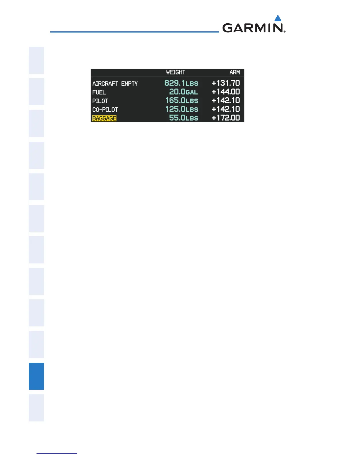
If the Loading Limit for a particular station is exceeded, the station name will
turn yellow.
Loading Limit Exceeded
EPE CIRCLE
Estimated Position Error (EPE) indicates the accuracy of the position fix. EPE
uses Dilution of Precision (DOP) and other factors to calculate a horizontal position
error. DOP measures satellite geometry quality (i.e., number of satellites received
and where they are relative to each other).
Setting up and customizing the EPE circle for the map page:
1)
From the Map Page press the MENU Key.
2)
Turn or move the FMS Joystick to highlight ‘Set Up Map’ and press the
ENT Key.
3)
Turn the FMS Joystick to select the ‘Miscellaneous’ from the horizontal
list.
4)
Move the FMS Joystick to highlight the desired feature.
5)
Turn the
FMS
Joystick to select ‘On’ or ‘Off’, and press the
ENT
Key.

 Loading...


