NRI Grazing Land On-Site Data Collection
(03/23/20011) B-22
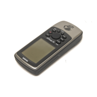
North Reference
Choose from True, Magnetic, Grid, and User (Auto, as stated in the manual, is not an
option). The North Reference is used for calculating heading information.
True – Provides headings based on a true north-pole reference.
Magnetic – Provides headings based on the magnetic north.
Grid – Provides headings based on a grid north reference (UTM UPS coordinates).
User – Provides headings based on magnetic north, but allows a user to enter
magnetic variation. Warning: The Magnetic Variation must be updated periodically
when using this setting.
For NRCS work either Magnetic or Grid north references are most commonly used.
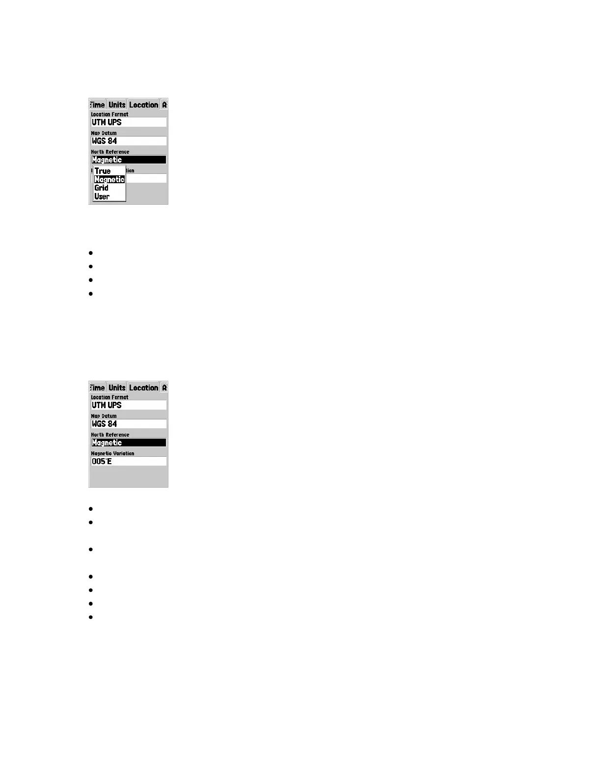
Magnetic Variation
The difference between true north and magnetic north.
There is a difference between magnetic and true north that varies with latitude and
longitude.
The difference is commonly known as declination but Garmin refers to it as
variation.
Variation is automatically computed by the Map76 based on current position.
Use this figure when working with external navigation aids such as compasses.
It is more current than the information published on most topographic maps.
It is derived from the unit‟s position relative to the World Magnetic Model (WMM).
See Manual Pg. 59