NRI Grazing Land On-Site Data Collection
(03/23/20011) B-24
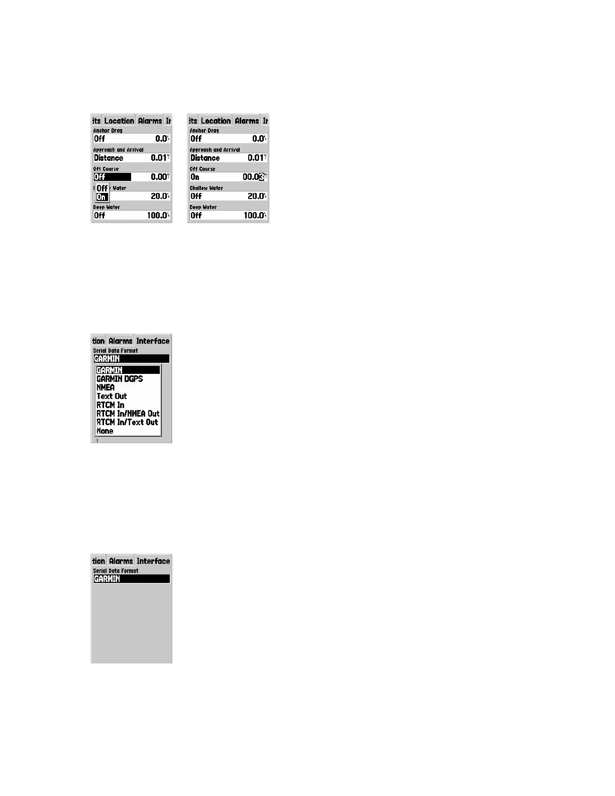
Off Course – Alerts you when you‟ve deviated more than the set distance from your
course to your destination.
Note: 0.01 mile equals 52.8 feet. 0.03 mile equals 152.2 feet.
Shallow Water – Not useful for most NRCS activities.
Deep Water – Not useful for most NRCS activities.
Manual; Pg. 60
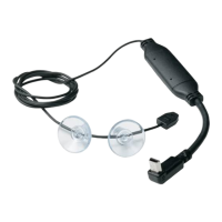
Interface Tab Options
Press the right ROCKER key to move to the Interface tab.
The Interface tab contains settings for one field initially – Serial Data Format. The field
contains eight settings that let the Map76 communicate with computers and other
compliant devices.
Garmin – The Map76 can communicate with Garmin Mapsource ™ and other software
installed on PCs.