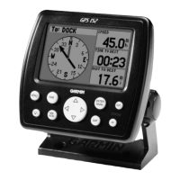
Do you have a question about the Garmin GPSMAP 751 and is the answer not in the manual?
Describes the different display modes for echoMAP and GPSMAP series devices.
Explains how to interact with the device using the touchscreen interface.
Instructions on how to prevent accidental touchscreen inputs.
Details the functions of the physical buttons on the device.
Provides helpful navigation shortcuts and tips for using the device.
Explains how the device acquires and uses GPS satellite signals.
Covers adjusting backlight brightness and color mode for optimal viewing.
Instructions on adding, rearranging, and removing items on the Home screen.
Guide on how to insert and use optional memory cards.
Describes the Navigation and Fishing charts and their uses.
Explains how to zoom, pan, and select items on the chart views.
Details common chart symbols and how to view information about objects.
Instructions for navigating to specific points or objects on the chart.
Details on premium chart features like 3D views, tide stations, and aerial photos.
Explains AIS symbols and how to identify and track AIS targets.
Describes how heading and projected course are displayed for AIS targets.
How to configure the display of AIS vessels on chart and 3D views.
Instructions for activating, viewing, and deactivating AIS targets.
Covers AIS distress signals, safe-zone collision alarms, and test alerts.
How to disable AIS signal reception on the chartplotter.
Overview of settings applicable to chart and 3D chart views.
Configuring how waypoints and tracks are displayed on charts.
Customizing data overlays and fields displayed on charts.
Settings for the navigation inset and compass tape data bar.
Adjusting map orientation, detail, symbols, and other visual aspects.
Configuring settings for Navigation and Fishing charts.
Answers to common questions about device navigation.
Methods for searching and selecting destinations by name or chart.
Guidance on setting and following direct courses, routes, and Auto Guidance.
Creating, marking, editing, and navigating to waypoints.
Creating, saving, editing, and navigating saved routes.
Recording, saving, editing, and navigating recorded tracks.
Configuring track recording intervals and memory management.
Selecting and customizing screen combinations.
Viewing trip, engine, fuel, wind, and environment gauges.
Instructions on resetting trip gauge data.
Accessing tide, current, and celestial data.
How to view historical or future tide, current, or celestial information.
Accessing almanac information from the navigation chart.
Describes full-screen, split-zoom, and split-frequency sonar views.
Covers pausing, creating waypoints, adjusting gain, range, and zoom.
Configuring sonar settings, appearance, alarms, and graphs.
Instructions for recording and stopping sonar display.
Introduction to radar functionality and safety warnings.
Details on cruising, harbor, offshore, Sentry, and overlay modes.
Instructions for transmitting radar signals and setting up Sentry mode.
Setting up guard zones and adjusting radar zoom scale.
Using radar overlay on charts and aligning radar data with chart data.
Techniques for optimizing radar display for clarity and accuracy.
Adjusting gain, sea clutter, rain clutter, and cross talk for optimal performance.
Configuring radar display orientation, appearance, and front-of-boat offset.
Integration of chartplotter with VHF radio for DSC communication.
Viewing, adding, and managing DSC contacts and calls.
Handling incoming distress calls and navigating to distressed vessels.
Tracking vessels and viewing position reports via DSC.
Setting up and making individual routine calls using DSC.
Connecting and configuring analog video sources.
Overview of SiriusXM satellite weather and radio features.
Requirements and setup for SiriusXM satellite services.
Information on weather data availability and display.
Details on precipitation, cloud cover, storm cells, and forecasts.
Viewing marine forecasts, surface winds, wave data, and fishing information.
Superimposing weather information on charts.
Customizing channel guides, presets, and volume for SiriusXM radio.
Settings for automatically powering on the chartplotter.
Configuration options for display, sound, language, GPS, and system information.
Managing NMEA, wireless devices, and Bluetooth connections.
Configuring navigation, system, fuel, and weather alarms.
Adjusting route labels, Auto Guidance, and turn transition settings.
Configuring AIS and DSC settings for other vessels.
Copying, backing up, and restoring waypoints, routes, tracks, and maps.
Includes device registration, calibration, software updates, and screenshots.
Details on NMEA 0183 sentences and NMEA 2000 PGN information.
| Display Resolution | 800 x 480 pixels |
|---|---|
| Waterproof Rating | IPX7 |
| Garmin Marine Network Ports | 1 |
| NMEA 0183 Input Ports | 2 |
| NMEA 0183 Output Ports | 1 |
| NMEA 2000 Ports | 1 |
| Video Input Ports | 1 |
| Power Input | 10-32 VDC |
| Display Size | 7" |
| Display Type | WVGA |
| GPS Accuracy | < 3 meters |
| GPS Receiver | High-sensitivity GPS |
| Chart Compatibility | BlueChart g3, LakeVü g3 |
| Connectivity | Wi-Fi, Bluetooth |
| Preloaded Maps | Yes |
| Waypoints/Routes/Tracks | 100 routes |
| Mounting Options | Flush mount or bracket mount |
| Memory | Internal storage |
| Sonar Compatibility | Yes |

