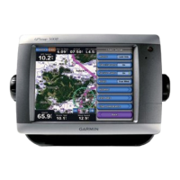
Do you have a question about the Garmin GPSMAP 546 and is the answer not in the manual?
Instructions on how to power the chartplotter unit on and off.
Guides the user through the initial setup process upon first power-on.
Explains how to adjust the screen brightness for optimal viewing.
Information on how the unit obtains GPS satellite data for positioning.
Procedure to reset the unit to its original factory default settings.
Locating and navigating to waypoints, routes, tracks, and services.
Covers creating, editing, moving, and deleting waypoints.
Details on creating, editing, saving, and navigating routes.
How to integrate and use a Garmin autopilot with the chartplotter.
Configures the safe zone alarm for collision avoidance with AIS targets.
Adjusts general system settings like simulator, display, and auto power.
Sets measurement units for depth, temperature, distance, speed, etc.
Sets preferences for navigation features like route labels and turn transitions.
Manages settings for serial ports and NMEA data communication.
Configures NMEA 2000 devices, engines, and tanks on the network.
Allows setting audible alarms for various conditions like arrival or system status.
Configures alarms related to navigation, such as arrival, anchor drag, and off course.
Sets audible alarms for sonar-related conditions like shallow water or fish detection.
Configures an alarm for when the total onboard fuel reaches a specified level.
Sets boat-specific parameters like keel offset and fuel capacity.
Manages settings for displaying and interacting with other vessels.
Configures the safe zone alarm for collision avoidance with AIS targets.
Define and adjust universal sonar screen settings.
Features available when connecting the chartplotter to a VHF radio.
How the unit alerts and handles incoming DSC distress calls.
Handling man-overboard distress calls initiated via a connected VHF radio.
Initiating man-overboard distress calls directly from the chartplotter.
Technical specifications for the GPSMAP 400/500 series devices.
Lists and explains on-screen messages and unit operating alerts.
How to capture screenshots of the unit's display and transfer them.
| Display Size | 5 inches |
|---|---|
| Waterproof Rating | IPX7 |
| GPS Receiver | High-sensitivity |
| Chartplotter | Yes |
| Waypoints | 3000 |
| Routes | 100 |
| Antenna | Internal |
| Touchscreen | No |
| Tracks | 10, 000 points; 50 saved tracks |
| NMEA input/output | NMEA 0183 |
| Networking | NMEA 0183 |
| Sonar Compatibility | Yes |
| Display Type | QVGA color TFT |
