Do you have a question about the Garmin nuvi 2589 lmt and is the answer not in the manual?
Connects the device to vehicle power for charging and operation.
Access Garmin Express for product registration, manuals, and software/map updates.
Steps to download and install the latest map and software updates.
Conserves battery power by putting the device into sleep mode.
Properly shuts down the device.
Resets the device if it stops functioning correctly.
Explains the process of acquiring satellite signals for navigation.
Changes the display brightness for better visibility.
Controls the device's audio volume.
Details the icons displayed on the status bar and their meanings.
Sets the device's time automatically or manually.
Searches for places using predefined categories.
Searches by entering keywords like category, name, or address.
Finds a location by entering a specific street address.
Accesses a list of the last 50 destinations found.
Finds a location by specifying two intersecting streets.
Saves a found location for future reference.
Saves the device's current position.
Sets a frequently visited location like home for quick access.
Explains custom POIs and how they can provide alerts.
Installs software for custom POI lists.
Begins navigating to a chosen destination.
Adjusts settings for route calculation methods.
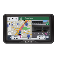
Explains how the route is displayed on the map with guidance cues.
Adds an intermediate stop to an active route.
Navigates around road closures or obstacles.
Finds nearby businesses and services along the current route.
Accesses data related to trips, like speed and distance.
Reviews a record of paths traveled by the device.
Utilizes predicted routes based on travel history and myTrends.
Accesses details about the device's current position.
Locates essential services like fuel stations or hospitals.
Sets preferences to avoid specific road types or features.
Explains how to define specific areas or roads to avoid.
Selects shortcuts that appear in the map tools menu.
Controls which data appears on the map, like POI icons.
Information about safety camera locations and speed limits.
Information about traffic alerts, receivers, and coverage.
Checks for traffic incidents along the current route.
Displays color-coded traffic flow and delays on the map.
Alerts and recalculates routes due to traffic delays.
Customizes the phrase used to activate voice command.
Navigates to locations using voice commands.
Overview of Bluetooth connectivity for hands-free calling.
Connects the device to a compatible mobile phone via Bluetooth.
How to make calls using the device.
Overview of the Smartphone Link application and its functions.
Instructions for obtaining the Smartphone Link app.
Establishes a connection between the device and the Smartphone Link app.
Introduction to ecoRoute for fuel economy tracking.
Information on the ecoChallenge feature for scoring driving habits.
Steps for inserting a memory card into the device.
How to connect the device to a computer via USB.
Safely removes the device from the computer after data transfer.
Adjusts map appearance and vehicle icon settings.
Configures various navigation preferences like calculation mode and avoidances.
Manages Bluetooth connectivity and device settings.
Adjusts screen orientation, color mode, brightness, and timeout.
Technical specifications like operating and charging temperature ranges.
Methods for charging the device's battery.
Steps to replace the fuse in the vehicle power cable.
Solutions for issues with the suction cup's adhesion.
Troubleshooting steps for GPS signal acquisition problems.
Resolves issues with the device not charging in a vehicle.
Tips for improving battery life and charge retention.
Troubleshoots Bluetooth pairing and connection problems with a phone.


