EasyManua.ls Logo

Haiyang HIS-70R User Manual

Haiyang HIS-70R
58 pages
To Next Page IconTo Next Page
Page #1 background imageLoading...
Page #1 background image
- 1 -
Important Notice
Manual
Handling
Keep this manual in a safe place where you can access it quickly.
This Manual must be passed to a new owner of the HIS-70R when it is
transferred.
The Global Positioning System (GPS) consists of a total 24 GPS satellites that orbit the earth,
enabling you to determine your position anywhere in the world, 24 hours a day, if you can receive
satellite signals. During actual navigation, carefully compare the position data with all available
navigation sources such as Loran C, Decca, other navigators, charts, visual navigation, depth, water
temperature and others. It is your responsibility to make navigation judgments.
DGPS Operation Note :
Your position can be improved by DGPS correction. However, when you are communicating with other
ships, you may use a DGPS corrected position but they may not. Make your position source known
during communication.
The Electronic Chart :
Only official authorized charts and notices to mariners contain all the information needed for the safety
of navigation and, as always remember, the user is responsible for their prudent use.
Pictorials
This manual uses the following symbols for easy understanding safety instructions. Always follow
these instructions carefully.
WARNING
Always follow this safety instruction to prevent death or injury.
CAUTION
Follow this safety instruction to avoid possible injury or damage to your
property.
Symbol “” is a CAUTION or WARNING label indicating the safety
instruction.
WARNING
This symbol is an Electrical Shock WARNING label.
Symbol “ ” is an instruction that you must not violate.
(This symbol instructs NOT to disassemble the system components)
Symbol “ ” is an operation instruction that you must follow.
(This symbol shows the main power OFF instruction.)
Question and Answer IconNeed help?

Do you have a question about the Haiyang HIS-70R and is the answer not in the manual?

Haiyang HIS-70R Specifications

General IconGeneral
BrandHaiyang
ModelHIS-70R
CategoryFish Finder
LanguageEnglish

Summary

Pictorial Safety Symbols

Explanation of Safety Icons

Explains symbols used for safety instructions and their meanings.

Installation Cautions

Power Source and Electrical Safety

Use correct voltage; discharge capacitors; ensure power is OFF for maintenance.

Maintenance Cautions

HIS-70R Specifications

General, Chartplotter, and GPS Receiver Specs

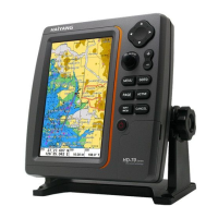
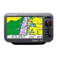
Details display, temperature, chartplotter features, and GPS receiver parameters.

AIS Specification Details

Covers electrical interfaces, VHF transceiver, bit rate, and VHF receiver specs.

HIS-70R Keypad Operations

Operations

AIS Menu and Vessel List Navigation

Accesses AIS menu and displays a list of current vessels in view.

AIS Alarms, Timeouts, and Vessel Labels

Manages alarms, timeouts, vessel labels, and cursor information.

Operations

Screen Customization

Data Bar Customization

Navigation Data Customization

Map Orientation Settings

Menu Options Overview

Advanced Menu: Userdata

Waypoint (WPT) Management and Symbol Selection

Covers WPT management, symbol selection, size, and color customization.

Advanced Menu: Userdata

Advanced Menu: Track Settings

Advanced Menu: Track Setup

Advanced Menu: GPS Settings

Coordinate System, Datum, Filters, and Units

Configures GPS settings including coordinate system, datum, filters, and units.

Advanced Menu: Setup Options

Unit Settings for Measurement, Compass, and Time/Date

Sets units for measurement, compass, and time/date configurations.

Advanced Menu: Setup Options

Advanced Menu: Customization

Advanced Menu: Maintenance

Chartplotter Menu: Map Settings

Map Display Configuration: Data, Scale, Palette, LAT/LOT, Selection

Configures map display elements, palette, and chart selection.

Chartplotter Menu: HY-Map Settings

HY-Map Display Features: Depth, Banks, Color, Info, EEZ, Magnification

Configures various display features for HY-Map charts.

Chartplotter Menu: C-Map Settings

C-Map Display Features: SAT Image, Font, View, Boundaries, Language

Configures C-Map display features including SAT image, fonts, view, and language.

Chartplotter Menu: Vessel and Alarm Settings

Vessel Display and Navigation Alarms Setup

Configures vessel display and sets navigation alarms like arrival and XTE.

Chartplotter Menu: Alarm and Interval Settings

NMEA 0183 Messages

Installation Guide

GPS Antenna and Receiver Installation Requirements

Specifies GPS antenna requirements and GPS receiver installation considerations.

HIS-70R Power Connection

Details how to connect the power cable to the HIS-70R system.

Installation Guide

GPS System Overview

GPS Antenna Installation

Optimal GPS Antenna Placement Guidelines

Provides detailed instructions for the optimal placement of the GPS antenna.

Related product manuals