Do you have a question about the JRC JMR-9282-S and is the answer not in the manual?
Details the procedures for powering the radar on and off, including preheating and exiting operations.
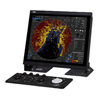
Explains how to adjust screen brightness, observation range, and other image parameters for optimal viewing.
Details how to acquire, track, and manage targets, including manual and automatic acquisition.
Explains how to enable, activate, deactivate, and display AIS target information.
Describes sea clutter and rain/snow clutter phenomena and how to mitigate their effects.
Explains common causes of false echoes on the radar display, such as shadow and side lobe effects.
Details the procedure for powering on and starting the ECDIS system.
Covers the process of saving a route file, including overwriting and naming new files.
Explains how to create and edit a route file using table editing methods.
Details how to create and edit a route plan directly on the chart using graphic editing tools.
Explains how to check route data against safety standards and limits using the Check Route dialog.
Enables monitoring of own ship's position, heading, speed, and ETA using a planned route.
Used to monitor voyage statuses, execute course changes, and terminate automatic navigation.
Used to calculate expected WPT arrival time, time required, and required ship speed.
Describes setting a circular or polygonal monitoring area around the own ship for anchor watch.
Details the procedures for starting and ending the dragging anchor monitoring function.
Explains how to change the size and shape of the monitoring area or delete it on the chart.
Provides a step-by-step guide for initiating the automatic sailing process using a wizard.
Explains how to select an existing planned route or create a new one for automatic sailing.
Covers the final steps to start automatic sailing after configuration, including safety checks.
Explains the procedure to stop the automatic sailing function and revert to manual control.
Lists and describes potential alerts and their countermeasures during automatic sailing.
Explains how to update a chart manually via the [Manual Update] menu.
Outlines the procedure to create and edit user charts using menus and map creation tools.
Explains how to use drawing tools, information bars, and object selection for chart creation.
Details the procedure for manually updating charts using map creation tools on the ECDIS screen.
Provides a procedure to update charts manually using map creation tools.
Details procedures for adding new events and editing existing event detail information.
Covers setting various screen display options, including Own Ship symbols and tracks.
Explains how to set up radar overlay and adjust the transparency of echoes and trails.
Covers setting up the display of TT/AIS target symbols, vectors, and IDs.
Explains how to set the display of danger detection highlights for graphical indications.
Explains how to open the Alert dialog and select setting items for alert configuration.
Details setting conditions for collision avoidance alerts, including CPA/TCPA limits.
Covers setting conditions for automatic acquisition target alarms, including AZ settings.
Explains setting conditions for grounding avoidance alerts, like safety contour approach alarms.
Details setting up alert actions, reactivation times, and transfer to BNWAS.
Covers basic radar signal processing settings like Gain, Sea, and Rain clutter adjustment.
Details various radar signal processing methods, including video latitude and noise rejection.
Details how to perform operation tests for target tracking, including test video and simulator scenarios.
Covers how to turn the target track function on or off via the settings dialog.
Explains how to set automatic sailing parameters like tracking gain and drift correction.
| Brand | JRC |
|---|---|
| Model | JMR-9282-S |
| Category | Marine Radar |
| Language | English |