EasyManua.ls Logo

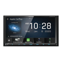
Kenwood DNX4250BT User Manual

Kenwood DNX4250BT
40 pages
To Next Page IconTo Next Page
Page #1 background imageLoading...
Page #1 background image
GPS NAVIGATION SYSTEM
DNX7250DAB
DNX525DAB
DNX5250BT
DNX4250DAB
DNX4250BT
GPS NAVIGATION
INSTRUCTION MANUAL
© IM382_Nav_E_En_00

Table of Contents

Other manuals for Kenwood DNX4250BT

Question and Answer IconNeed help?

Do you have a question about the Kenwood DNX4250BT and is the answer not in the manual?

Kenwood DNX4250BT Specifications

General IconGeneral
MP3 playbackYes
Audio formats supportedAAC, MP3
FM band range87.5 - 108 MHz
Supported radio bandsAM, FM, LW, MW
Preset stations quantity24
Display typeLED
Display diagonal6.1 \
USB version2.0
Bluetooth version3.0+HS
Line outputs (RCA)3
USB ports quantity1
Product colorBlack
Disc types supportedCD, CD-R, CD-RW, DVD, DVD+R, DVD+RW, DVD-R, DVD-RW
Weight and Dimensions IconWeight and Dimensions
Weight2000 g
Dimensions (WxDxH)181.7 x 160.3 x 112.2 mm

Summary

End-User License Agreements

Software License Agreement

Agreement for the use of software embedded in the device.

End User License Agreement

Agreement for the device, application, or downloaded content.

Getting Started

Help When You Need It

Access help information and support topics within the device.

Searching Help Topics

Find specific help topics within the device's help menu.

Status Bar Icons

Explanation of icons displayed in the status bar of the main menu.

Satellite Signals

Using the On-Screen Buttons

Use on-screen buttons for navigation and control.

Using the On-Screen Keyboard

How to use the on-screen keyboard for input.

Adding a Shortcut

Create shortcuts for frequently used locations or categories.

Removing a Shortcut

Delete existing shortcuts from the device.

Finding Locations

Finding a Location by Category

Search for locations using categories.

Searching Within a Category

Narrow search results within categories.

Finding a Location Using the Search Bar

Search for locations by text input.

Changing the Search Area

Modify search area for locations.

Finding Fuel Stations and Prices

Finding an Address

Finding a City

Finding an Intersection

Finding a Location Using Coordinates

Finding a Location by Browsing the Map

Find a Location Using Quick Search

Saving a Home Location

Going Home

Editing Your Home Location Information

Finding Recently Found Places

Clearing the List of Recently Found Places

Finding Parking

Setting a Simulated Location

Saving a Location

Saving Your Current Location

Starting a Route to a Saved Location

Editing a Saved Location

Assigning Categories to a Saved Location

Deleting a Saved Location

Navigation

Starting a Route

Begin navigation to a destination.

Previewing Multiple Routes

View and select from different route options.

Following a Route

Navigate along a calculated route.

Using the Navigation Map

Interact with and view the navigation map.

Adding a Point to a Route

Taking a Detour

Stopping the Route

Using Suggested Routes

Using Exit Services

Finding Exit Services

Navigating to an Exit

Using Find Ahead

Avoiding Road Features

Adding a Custom Avoidance Area

Avoiding a Road

Disabling a Custom Avoidance

Deleting Custom Avoidances

Enabling Advanced Detours

Taking a Detour Around Specified Areas

The Map Pages

Customizing the Map Layers

Adjust map display elements like points of interest.

Viewing the Trip Log

Review recorded trip paths and travel history.

Changing the Map Data Field

Customize displayed map data fields.

Changing the Map Perspective

Adjust map view angle and orientation.

Customizing Map Buttons

Add or edit shortcut buttons on the map.

Removing Buttons from the Map

Remove map shortcut buttons.

Viewing a List of Turns

Viewing Junctions

Viewing the Entire Route on the Map

Viewing the Next Turn

Viewing Traffic Alerts

Viewing Trip Information

Resetting Trip Information

Viewing Current Location Information

Finding Nearby Services

Directions to Your Current Location

Using the Apps

About Smartphone Link

Overview of the Smartphone Link app for live data.

Downloading Smartphone Link

Steps to download and install the Smartphone Link app.

Connecting to Smartphone Link

Establish connection between device and Smartphone Link.

Sending a Location from Your Phone

Transfer locations from phone to device.

Disabling Calls While Connected

Manage hands-free calling when connected.

About Garmin Live Services

Subscribing to Garmin Live Services

About ecoRoute

Creating a Vehicle Profile

Resetting Your Vehicle Profile

Calibrating Fuel Economy

Taking the ecoChallenge

About ecoChallenge Scores

Hiding Your ecoChallenge Score

Resetting Your Score

Viewing Your Fuel Economy

About the Mileage Report

Viewing a Mileage Report

Exporting a Mileage Report

Setting Routes that Use Less Fuel

Viewing myGarmin Messages

Viewing the Weather Forecast

Viewing Weather Near a Different City

Viewing the Weather Radar

Viewing Weather Alerts

Checking Road Conditions

Planning a Trip

Editing a Trip Itinerary

Navigating to a Saved Trip

Editing a Saved Trip

Using the World Clock

Viewing the World Map

Finding Parking

Traffic Information

Traffic Subscription Activation

Activate traffic data subscriptions for regions or countries.

Understanding Traffic

How the navigation system receives traffic data.

Traffic Data Using Smartphone Link

Use traffic data via Smartphone Link connection.

About the Traffic Icon

Explanation of traffic icon colors and their meanings.

Traffic on Your Route

Viewing Traffic on Your Route

Manually Avoiding Traffic on Your Route

Taking an Alternate Route

Viewing Traffic on the Map

Searching for Traffic Delays

Viewing a Traffic Incident on the Map

Understanding Traffic Data

About Traffic Cameras

Saving a Traffic Camera

Viewing a Traffic Camera

Adding a Traffic Subscription

Customizing the Settings

Customizing the Navigation System

Adjust core navigation system settings.

Changing the Map Settings

Modify map display and appearance.

Enabling Maps

Activate specific map data.

Changing the Navigation Settings

Configure navigation behavior and preferences.

Adjusting the Display Settings

Customize screen appearance and brightness.

Route Preferences

Set route calculation criteria.

Updating the Time Settings

Setting the Languages

Adding Security

Device and Privacy Settings

Restoring Settings

Appendix

Updating the Software

Install the latest system software via USB.

Updating the Map Data

Purchase and install new map data.

Safety Cameras

Information on safety camera alerts and database.

Custom POIs (Points of Interest)

Load custom points of interest databases.

Finding Custom POIs

Locate custom points of interest on the map.

Related product manuals