Do you have a question about the Leica GS14 and is the answer not in the manual?
Details regarding the purchase of the Leica GS14/GS16 GNSS instrument.
Information on locating the model and serial number on the product's type plate.
Lists registered trademarks associated with the product and its components.
Clarifies the applicability of the manual to different GS14/GS16 models.
Lists supplementary documentation and online resources for the GS14/GS16.
Covers the manual's introduction, user responsibilities, and warning signal words.
Details intended use, foreseeable misuse, and operational limits and environments.
Outlines the duties of the manufacturer and the person responsible for the product.
Details risks from electrocution, traffic, securing sites, mechanical shock, and lightning.
Covers EMC, FCC, and ICES statements for product compliance and operation.
Lists and describes the main components of the GS14/GS16 GNSS system.
Explains the overall software and power concepts for the GS instruments.
Details how data is stored using the microSD card on the GS14/GS16 instrument.
Lists and illustrates the items included in the product's carrying case.
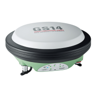
Identifies and describes the physical components of the GS14/GS16 instrument.
Describes the ON/OFF and Function buttons of the GS14/GS16 keyboard.
Explains how to operate the instrument using buttons or a field controller.
Provides guidance on setting up the equipment for various operations.
Details the procedure for setting up the instrument as a real-time base station.
Explains how to set up the instrument as a real-time rover.
Provides step-by-step instructions for mounting the field controller securely.
Guides on connecting the instrument to a PC for data transfer and software installation.
Explains how to access the instrument's web server for status and configuration.
Covers operating principles for batteries and how to change them.
Instructions for inserting and removing the microSD card.
Details on inserting and removing the SIM card for RTK functionality.
Explains the meaning of the LEDs on the GS14/GS16 instrument for status indication.
Provides advice on setting up the instrument for accurate GNSS survey results.
Covers safe practices for transporting the equipment in various scenarios.
Provides guidelines for storing the product and its batteries properly.
Instructions for cleaning and drying the product and its accessories.
Details satellite reception and tracking capabilities for GS14 and GS16.
Provides accuracy figures for differential code and phase measurements.
Covers dimensions, weight, recording capacity, and power consumption.
Details internal and external battery types, voltages, capacities, and operating times.
Lists electrical data, frequencies, gain, and noise figure for GS14 and GS16.
Outlines operating and storage temperatures, and protection against water, dust, and humidity.
Details compliance with FCC, European directives, and Japanese regulations.
Lists antenna types and their corresponding gain (dBi) for different radio systems.
Addresses regulations for transporting products powered by lithium batteries.
Explains instrument ports and provides pin assignments for Port 1.
| GPS | L1, L2, L2C, L5 |
|---|---|
| GLONASS | L1, L2 |
| Galileo | E1, E5a, E5b |
| BeiDou | B1, B2 |
| SBAS | WAAS, EGNOS, MSAS, GAGAN |
| QZSS | L1, L2C, L5 |
| RTK Initialization Time | < 10 seconds |
| Data Logging Rate | Up to 20 Hz |
| Power | Rechargeable Li-Ion battery |
| External Power | 9-18 V DC |
| Operating Temperature | -40°C to +65°C |
| Ingress Protection | IP68 |
| RTK Accuracy | H: 8 mm + 1 ppm, V: 15 mm + 1 ppm |
| Static Accuracy | Horizontal: 3 mm + 0.5 ppm, Vertical: 5 mm + 0.5 ppm |
| Communication | Bluetooth, USB |