Do you have a question about the Leica GS20 and is the answer not in the manual?
Steps to open GISDataPro, create/open a project, and access Codelist Manager.
Guide to creating a new codelist, naming it, and entering author details.
Instructions on adding new codes, specifying type, and description for the codelist.
How to add attributes, set properties like type and value region, and display properties.
Process for importing code definitions from an existing Shapefile into the codelist.
Open GISDataPro and the Sensor Transfer window via the Tools Menu.
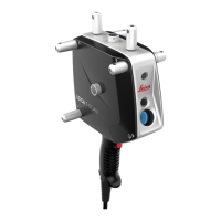
Connect GS20 via serial cable, turn it on, and navigate menus to Sensor Transfer.
Locate the codelist in Sensor Transfer and select it for transfer to the GS20.
Import Shapefile waypoints and create a new project in GISDataPro.
Open Sensor Transfer window and connect the GS20 device.
Select the waypoint project in Sensor Transfer and send it to the GS20 PC-Card.
Understand GS20 display icons and navigate the interface using buttons and keys.
Manage job files and collect points, lines, polygons, and waypoints on the GS20.
Proper procedure for powering down the GS20 unit.
Open GISDataPro and Sensor Transfer window from the Tools Menu.
Connect GS20 to PC, turn on, and select the correct port for transfer.
Navigate Sensor Transfer to find job files and select them for download.
Send selected job files from GS20 to PC's hard disk for storage.
Import the GPS raw data file into GISDataPro for processing.