Do you have a question about the Magellan GPS 3000 and is the answer not in the manual?
Emphasizes importance of user discretion for safe GPS operation.
Advises caution regarding GPS accuracy due to external factors.
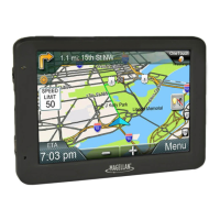
An overview welcoming the user to the Magellan GPS 3000 satellite navigator.
Lists the items included in the GPS 3000 package for user verification.
Explains the formatting, symbols, and methods used throughout the manual.
Defines key GPS terminology and concepts for user understanding.
Provides a brief overview of the features and capabilities of the GPS 3000 unit.
Step-by-step instructions for correctly installing AA batteries into the GPS 3000.
Guide to setting initial position, date, and time for optimal GPS performance.
Explains the importance of a clear sky view for acquiring satellite signals.
Instructions on how to obtain a current geographical position fix from satellites.
Procedure for storing the current position fix as a named waypoint.
Guide to manually entering coordinates to create a new waypoint.
Steps to set a direct course from current position to a selected waypoint.
Overview of the different navigation screens and how to cycle through them.
Covers turning the GPS 3000 receiver on and off, and managing the display backlight.
Detailed information on managing waypoints: saving, creating, editing, viewing, and deleting.
Explains the buffer that stores recent position fixes automatically.
Instructions on how to set and activate a direct course to a waypoint.
Overview of the six different navigation screens for position and progress tracking.
Displays current position, elevation, time, and destination direction if active.
Provides sunrise, sunset, and lunar visibility information for a selected date.
Shows bearing, distance, COG, and SOG to the current leg's destination.
Displays course to steer (CTS), VMG, COG, and SOG for navigation.
Points towards the destination, showing bearing, distance, and time to go.
Graphically displays track history, bearing, and distance to destination.
Allows cursor interaction with waypoints on the plotter screen.
Function to clear the track history displayed on the plotter screen.
Graphical display of cross track error and course direction indicator.
Methods to access the menu for managing existing routes.
Guide to creating multi-leg routes using memory waypoints (1-20 legs).
Procedure to turn off an active route while retaining it in memory.
How to turn on a previously deactivated route for navigation.
Mirrors an existing route sequence for return navigation.
Allows viewing, inserting, deleting, and replacing legs within a route.
How to add a waypoint between the start and end points of a route leg.
Procedure for removing a specific leg from a route.
How to swap a waypoint within a route leg with another waypoint.
Function to select a specific leg within a route to become the active leg.
How to view a graphical representation of a selected route leg.
Procedure for permanently clearing a route from the receiver's memory.
How to graphically review each leg of a route and change the active leg.
Clears all stored temporary position fixes from the Last Fix buffer.
Deletes the track history recorded on the plotter screen.
Permanently removes all saved waypoints from the Waypoint List.
Clears all user-entered memory and turns the unit off.
Sets the initial position to assist the receiver in acquiring satellite signals.
Allows selection of display formats like LAT/LON, UTM, or British Grid.
Option to choose between 3D (with elevation) or 2D (position only) calculation.
Configures time display format (24hr, AM/PM, UT) and allows time adjustment.
Selects the unit of measure for speed (knots, MPH, KPH).
Selects the unit of measure for distance (nautical miles, statute miles, km).
Selects the unit of measure for displaying elevation (meters or feet).
Allows selection of True North or Magnetic North for bearing measurements.
Matches GPS position calculations to specific map or chart datums.
Configures GPS data output format for interfacing with other devices.
Sets the communication speed for NMEA data output.
Determines how waypoints are listed: alphabetically or by proximity.
Adjusts track orientation and track history display settings.
Displays signal strength and relative position of tracked satellites.
Troubleshooting steps for issues with the GPS unit failing to power on.
Solutions for problems acquiring or maintaining satellite signal lock.
Explanation of the Geometric Quality (GQ) icon and potential causes.
Information on why elevation values might fluctuate during use.
Tips to improve battery life and troubleshooting short battery duration.
Explains the meaning of various icons displayed on the GPS screen.
Lists and explains system alerts, warnings, and error messages.
Details the parts and installation of the GPS swivel mounting bracket.
Provides latitude and longitude for various cities worldwide for initialization.
Covers GPS data output configuration for NMEA 0183 devices.
Explains settings for transferring GPS data via NMEA.
Details the structure and content of various NMEA data sentences.
Defines the structure of the NMEA APA autopilot data sentence.
Defines the structure of the NMEA APB autopilot data sentence.
Defines the NMEA BWC sentence for waypoint and bearing data.
Details the NMEA GGA sentence for GPS fix information.
Defines the NMEA GLL sentence for position and time data.
Defines the NMEA RMC sentence for transit and navigation data.
Discusses GPS positioning accuracy and factors affecting it.
Explains Differential GPS and its role in improving accuracy.
Lists resources for learning more about GPS technology and navigation.
Lists available accessories and replacement parts for the GPS 3000.
Defines key terms and abbreviations used in the GPS manual.