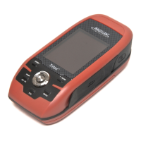
Do you have a question about the Magellan GPS 300 and is the answer not in the manual?
Details the one-time procedure to set the receiver's approximate location for first use.
Explains how the GPS 300 acquires satellite data to calculate the current location or position fix.
Instructions on how to mark and save the current position as a landmark.
Guide on creating a landmark at a different location than the current position.
Process for creating a one-leg route to a saved landmark.
Steps to access and view stored landmarks, including bearing and distance.
Instructions to modify the name of an existing landmark.
Procedure for removing a landmark from the device's memory.
Guide on linking multiple landmarks to create a multi-leg route.
How to review a summary and individual legs of a stored route.
Steps to set a route as active for navigation or deactivate it.
Procedure for removing an entire route from the device.
How to add a new leg to an existing route.
Process to select and activate a specific leg within a route for navigation.
Guide for re-initializing the receiver, useful after significant location changes.
Steps to resolve issues where the device fails to power on.
Solutions for slow or failed satellite signal acquisition.