Do you have a question about the Magellan GPS 315 and is the answer not in the manual?
Driver safety, device as an aid, not sole reliance.
Factors affecting GPS accuracy and accessory recommendations.
Outlines terms for using device software.
Describes the manual's structure and chapter content.
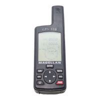
Describes the function of main buttons: QUIT, NAV, MARK, LIGHT, ENTER, GOTO, MENU, POWER.
Instructions for installing and replacing AA batteries in the receiver.
Importance of sky view and proper grip for signal reception.
Steps to turn on the device and auto-shutoff function.
Explains the process and purpose of initializing the receiver for the first time.
Guides users on selecting the preferred language for the receiver interface.
Explains key functions and the initialization alert.
Guides selection of region and area for initial positioning.
Explains how to use arrow keys to edit fields and enter data.
Guides user to input elevation, time, and select primary use (MARINE/LAND).
Explains common key presses for setup and navigation data entry.
Introduces the nine NAV screens and how to navigate them.
Explains Satellite Positions, Numbers, Signal Chart, Position Graph, and Battery Indicator.
Explains Position Icon, Error, and Second Coordinate System Access.
Instructions to view the secondary coordinate system screen.
Allows changing the four navigation fields displayed on the NAV 1 screen.
Guides on changing navigation data fields for the NAV 1 screen.
Explains Steering Indicator, Destination Icon, and COG Indicator.
Guides on changing navigation data fields for the Compass screen.
Allows changing the four navigation fields for the NAV 2 screen.
Guides on changing navigation data fields for the NAV 2 screen.
Explains Active Route, Plot Scale, and Track History.
Covers reviewing travel path and managing track history.
Covers orientation, plot rings, and course projection settings.
Sets scales and controls visibility of navigation data fields.
Allows changing the four navigation data fields displayed on the ROAD screen.
Guides on changing navigation data fields for the ROAD screen.
Explains Speed Icons, Speedometer, Odometer, and Trip Odometer.
Instructions on how to reset the Odometer field to zero.
Instructions on how to reset the Trip field to zero.
Allows setting the timing for speed averaging.
Displays Time, ETE, Time of Arrival, and Elapsed Time.
Guides users on changing the time format for display.
Instructions on how to reset the elapsed time to zero.
Explains how to create, edit, delete, project, and sort waypoints.
Details creating, activating, editing, and deleting various types of routes.
Covers Sun/Moon, Fish/Hunt, contrast, simulate, alarms, and messages.
Differentiates user-saved waypoints from pre-stored non-user waypoints.
Guides on saving a recorded position as a waypoint.
Steps to select and edit a user waypoint's data fields.
Instructions for managing messages associated with waypoints.
Instructions on how to delete unnecessary saved waypoints.
Guides on searching for non-user waypoints using smart scroll.
Explains how to change the order in which waypoints are displayed.
Allows creating a waypoint at a distance/direction from an existing one.
Introduces software for sending waypoints and guides on its use.
Instructions for creating and clearing GOTO routes.
Steps to create a GOTO route directly from the plotter screen.
How to create an instant route to last position and clear it.
Creates a route by retracing steps using track history.
Guides on creating a route with multiple waypoints.
Adds a waypoint or segment into an existing route.
Replaces an existing waypoint in a route with a new one.
Covers adding waypoints, deleting legs, saving, and activating/deactivating routes.
Covers reversing routes, viewing plot, and deleting routes.
Covers activating, deactivating, reversing, deleting, and backtracking with TrackRoute.
Displays solar/lunar calculations and fishing/hunting times.
Helps familiarize users with receiver by generating artificial position fixes.
Allows adjustment of screen brightness and contrast.
How to access the menu and set the Anchor Alarm.
Notifies user when within arrival circle, off course, or near waypoints.
Notifies user of poor GPS reception.
Managing alarms, messages, and restoring defaults.
Guides users on changing the receiver's language.
Covers receiver setup, initialization, and disabling NAV screens.
Allows selection of primary/secondary coordinates for position information.
Matches receiver datum to maps and selects 2D/3D elevation.
Sets time format, units of measure, and north reference.
Sets automatic light timeout and beeper activation conditions.
Allows inputting a name into the receiver.
Deletes data, resets settings, and configures NMEA output.
Matches receiver baud rate to external device for data connection.
Solutions for receiver not turning on, slow fixes, and short battery life.
Troubleshooting map datum, coordinate formats, and data saving problems.
Addresses unexpected power-off, often due to static electricity.
Covers differences in coordinate formats and 2D vs. 3D positioning.
Provides expected battery life under normal conditions.
Explains when to initialize and why the compass may be inaccurate.
Defines a backtrack route and how it uses track history.
Troubleshooting silent alarms and defining NMEA standard.
Troubleshooting GPS communication and Macintosh support.
Provides contact details for support and the RMA process for repairs.
Instructions for connecting various cables directly to the receiver.
Details connecting to external power and data sources, including pinouts.
Explains WAAS, its purpose, and expected accuracy improvements.
Outlines potential issues with WAAS signal coverage and service.
Lists various datums and their full names for coordinate system selection.
Details receiver performance like channels, acquisition times, and accuracy.
Describes physical dimensions, housing, power source, and battery life.
Lists available accessories like mounting brackets, cables, and software.
Defines terms from Active Leg to DST.
Defines terms from Ephemeris to Leg (Route).
Defines terms from LMK to TTG.
Defines terms from UTC to XTE.